Southwest Borehamwood
| Region of Southwest Borehamwood | |||||||||||||||||||||||
| |||||||||||||||||||||||
| Update Southwest Borehamwood's Danger Level | |||||||||||||||||||||||
Known groups in this region:
| |||||||||||||||||||||||
| Phone Mast: |

|
Please remember to keep this article neutral. |
Southwest Borehamwood is a suburb of Borehamwood.
Resource Buildings
|
Fire Stations
|
Hospitals
|
|
Police Stations
| |
|
Shopping Centres |
Billboards |
Recent News
Please: recent news at the top (signed & NPOV). Old news can be archived.
October 2008
October 28 2008
The mapping of this suburb has begun! (note that coordinates are not known for locations below)
Iwit: (36 iwitty links) --Janus Abernathy 17:25, 28 October 2008 (UTC)
PS: feel free to delete all the links above once the map's ready :)
- all parsed to User:Duke_Garland/BHW, thanks. --~~~~ [talk] 22:08, 28 October 2008 (UTC)
Scouted today:
--Jen 17:36, 28 October 2008 (UTC)
--Look at Central Borehamwood's new map template 22x22, and feel free to use it. Our suburb is confirmed to be 22 blocks wide, although the height is still undetermined. Hopefully all suburbs are of similar dimensions.--
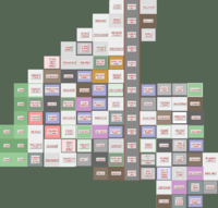
Suburb Map
I can not verify that the railway line goes all the way down, but i pretty much think so. Also I have added the 23rd and 24th column (because West Borehamwood has the same size), if thats wrong I'm sorry and will remove it.
- P.S: sorry for the mass editing but im kind of new to this stuff
--modernarnis 13:40 7 November 2008
| The Malton Suburb of Southwest Borehamwood |
