Northwest Borehamwood: Difference between revisions

From The Urban Dead Wiki
Jump to navigationJump to search
Line 115: Line 115:
location40=|
location40=|
location41=|
location41=|
location42=|
location42=the Craze building|location42_color=building|
location43=Isgar Library|location43_color=library|
location44=[[a railway line]]|location44_color=Railway|

Revision as of 21:17, 28 October 2008

Region of Northwest Borehamwood


Known Groups
Logo2.PNG Big Survivors Little Survivor

Northwest Borehamwood is a suburb of Borehamwood.

Resource Buildings

Fire Stations

  • Barrington Court Fire Station
  • Wheddon Walk Fire Station

Hospitals

  • Fabian General Hospital
  • St Birgitta's Hospital
  • St Juans Hospital
  • St Theodore's Hospital

Police Departments

  • Denning Row Police Station
  • Preller Grove Police Station
  • Walmsley Terrace Police Station

Malls

Bulletin Boards

  • Mobile-Phone Mast


Recent News

Please: recent news at the top (signed & NPOV). Old news can be archived.

October 2008

October 28 2008

The mapping of this suburb has begun! (note that coorindates are not known for locations below)

Can this help? 1, 2, 3, 4, 5, 6, 7 --Janus Abernathy 19:28, 28 October 2008 (UTC)


The first group in Borehamwood's history is formed. (Historic!) They are Big Survivors Little Survivor. --RosslessnessWant a Location Image? 14:42, 28 October 2008 (UTC)

NW Borehamwood 1

Someone else can take care of all the fancy wiki code. :P --Jen 16:14, 28 October 2008 (UTC)

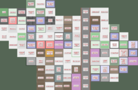
Suburb Map part 1

The Malton Suburb of Northwest Borehamwood
NW N NE
W
a field a field woodland a railway line woodland
a field Ayre Yard Garage woodland a railway line woodland
Ammonds Grove School a factory woodland a railway line woodland a field a field a field a field
Gosney Grove Hawke Street the Chitty Museum a railway line Wheddon Walk Fire Station a field a field a field a field
the Craze building Isgar Library a railway line Elmund Square a field a field a field
a field a junkyard Vaugham Avenue School a railway line wasteland Walmsley Terrace Police Station the Stolley Hotel
the Swoboda Monument St Theodore's Hospital Dunstone Square a railway line Beedall Towers Busker Alley Wiltshire Bank Caller Gardens
Gifford Place Lerwill Walk Underwood Way a railway line Bane Alley Battersby Park wasteland St Birgitta's Hospital St Aloysius's Hospital
Club Plater a railway line Donn Crescent St Alexander's Church wasteland wasteland
the Man Building Barnard Alley a railway line Chidzey Lane Bishop Alley
E
SW S SE


Suburb Map part 2

The Malton Suburb of Northwest Borehamwood
NW N NE
W
a railway line Chidzey Lane Bishop Alley
Thom Street a warehouse Kemble Court a railway line wasteland Shickell Lane
Ogburn Crescent Threadgold Grove The Plough Sparkes Street a railway line the kershaw building Alder Alley The Mester Museum
Beacham Way school Walling Square Clitsome Street St Elizabeth's church Furze Way school Bornard Crescent a railway line Lapley Park Oakeley Crescent the Style Building
the Hawksley Building Fabian General Hosptial St Juan's Hospital Club Wolseley the Maney Building Mannings Alley a railway line Uppill Bank Ogborn Park St Pio's Church
Swinnerten Street a junkyard the Hartree Hotel a warehouse Jayne Place Soughton Library a railway line Club Preen a Factory Corkery Road
a Factory Stidson Square a warehouse Forder Towers Smethurst Lane Reid Avenue a railway line Sawday Street Tutcher Street the Rabani Museum
wasteland Edmund Square Chubb Grove School Mensey Way The Flying Swan a railway line Stembridge Bank Denning Row Police Station a warehouse
a junkyard The Brittania Jarrett Road School Daniel Cinema Club Story a railway line the Every Building a Factory Wheadon Way
wasteland Dutton Square The New Inn wasteland Club Pirie a railway line
E
SW S SE