Central Borehamwood: Difference between revisions
Holtzfeller (talk | contribs) m (→Suburb Map) |
Holtzfeller (talk | contribs) |
||
| Line 940: | Line 940: | ||
location2922=[[the Winstow Building]]|location2922_color=building| | location2922=[[the Winstow Building]]|location2922_color=building| | ||
location3001=[[A Carpark]]|location3001_color=Carpark| | location3001=[[A Carpark]]|location3001_color=Carpark| | ||
location3002=[[Shutler Bank]]|location3002_color= | location3002=[[Shutler Bank]]|location3002_color=Bank| | ||
location3003=[[Aelred General Hospital]]|location3003_color= | location3003=[[Aelred General Hospital]]|location3003_color=Hospital| | ||
location3004=[[the Low Museum]]|location3004_color=Museum| | location3004=[[the Low Museum]]|location3004_color=Museum| | ||
location3005=[[a factory]]|location3005_color=Factory| | location3005=[[a factory]]|location3005_color=Factory| | ||
| Line 958: | Line 958: | ||
location3018=| | location3018=| | ||
location3019=| | location3019=| | ||
location3020=[[Healy Library]]|location3020_color= | location3020=[[Healy Library]]|location3020_color=Library| | ||
location3021=[[Bird Bank]]|location3021_color= | location3021=[[Bird Bank]]|location3021_color=Bank| | ||
location3022=[[The Talbot]]|location3022_color= | location3022=[[The Talbot]]|location3022_color=Arms| | ||
location3101=[[Dorvell Cinema]]|location3101_color= | location3101=[[Dorvell Cinema]]|location3101_color=Cinema| | ||
location3102=[[Wasteland]]|location3102_color= | location3102=[[Wasteland]]|location3102_color=Wasteland| | ||
location3103=[[the Acourt Monument]]|location3103_color=Monument| | location3103=[[the Acourt Monument]]|location3103_color=Monument| | ||
location3104=[[Whitelock Avenue]]|location3104_color=Street| | location3104=[[Whitelock Avenue]]|location3104_color=Street| | ||
location3105=[[a petrol station]]|location3105_color=Auto Repair| | location3105=[[a petrol station]]|location3105_color=Auto Repair| | ||
location3106=[[the Limberye Building]]|location3106_color= | location3106=[[the Limberye Building]]|location3106_color=Building| | ||
location3107=[[Meaden Street School]]|location3107_color=School| | location3107=[[Meaden Street School]]|location3107_color=School| | ||
location3108=[[The Coach and Horses]]|location3108_color=Arms| | location3108=[[The Coach and Horses]]|location3108_color=Arms| | ||
location3109=[[Cook Street School]]|location3109_color=School| | location3109=[[Cook Street School]]|location3109_color=School| | ||
location3110=| | location3110=[[Stidston Lane]]|location3110_color=Street| | ||
location3111=| | location3111=| | ||
location3112=| | location3112=| | ||
| Line 981: | Line 981: | ||
location3119=| | location3119=| | ||
location3120=| | location3120=| | ||
location3121=[[Meleady Avenue]]|location3121_color= | location3121=[[Meleady Avenue]]|location3121_color=Street| | ||
location3122=[[Malby Alley School]]|location3122_color= | location3122=[[Malby Alley School]]|location3122_color=School| | ||
location3201=[[The City Tavern]]|location3201_color=Arms| | location3201=[[The City Tavern]]|location3201_color=Arms| | ||
location3202=[[wasteland]]|location3202_color= | location3202=[[wasteland]]|location3202_color=Wasteland| | ||
location3203=| | location3203=| | ||
location3204=| | location3204=| | ||
location3205=| | location3205=| | ||
location3206=| | location3206=[[a warehouse]]|location3206_color=Warehouse| | ||
location3207=| | location3207=[[Venner Way]]|location3207_color=Street| | ||
location3208=| | location3208=[[Parden Road]]|location3208_color=Street| | ||
location3209=| | location3209=[[Sellwood Cinema]]|location3209_color=Cinema| | ||
location3210=| | location3210=[[Croom Walk]]|location3210_color=Street| | ||
location3211=| | location3211=| | ||
location3212=| | location3212=| | ||
| Line 1,003: | Line 1,003: | ||
location3219=| | location3219=| | ||
location3220=[[a petrol station]]|location3220_color=Auto Repair| | location3220=[[a petrol station]]|location3220_color=Auto Repair| | ||
location3221=[[Doe Alley]]|location3221_color= | location3221=[[Doe Alley]]|location3221_color=Street| | ||
location3222=[[the Willibrord Building]]|location3222_color= | location3222=[[the Willibrord Building]]|location3222_color=Building| | ||
location3301=[[a petrol station]]|location3301_color=Auto Repair| | location3301=[[a petrol station]]|location3301_color=Auto Repair| | ||
location3302=[[Josaphat General Hospital]]|location3302_color= | location3302=[[Josaphat General Hospital]]|location3302_color=Hospital| | ||
location3303=[[Thornton Way]]|location3303_color= | location3303=[[Thornton Way]]|location3303_color=Street| | ||
location3304=[[The Cable Museum]]|location3304_color= | location3304=[[The Cable Museum]]|location3304_color=Museum| | ||
location3305=[[Club Barter]]|location3305_color= | location3305=[[Club Barter]]|location3305_color=Club| | ||
location3306=| | location3306=[[the Holt Hotel]]|location3306_color=Hotel| | ||
location3307=| | location3307=[[a factory]]|location3307_color=Factory| | ||
location3308=| | location3308=[[St. Cyril's Church]]|location3308_color=Church| | ||
location3309=| | location3309=[[a junkyard]]|location3309_color=Junkyard| | ||
location3310=| | location3310=| | ||
location3311=| | location3311=| | ||
| Line 1,026: | Line 1,026: | ||
location3320=[[Stagg Library]]|location3320_color=library| | location3320=[[Stagg Library]]|location3320_color=library| | ||
location3321=[[St Alban's Church]]|location3321_color=church| | location3321=[[St Alban's Church]]|location3321_color=church| | ||
location3322=[[wasteland]]|location3322_color=wasteland | location3322=[[wasteland]]|location3322_color=wasteland| | ||
Revision as of 06:07, 30 October 2008
| Suburb of Central Borehamwood | ||||||||||||||||||||||||||||||||||||||||||||||||||||||||||||||||||||||||||||||||||||||||||||||||||||||
| ||||||||||||||||||||||||||||||||||||||||||||||||||||||||||||||||||||||||||||||||||||||||||||||||||||||
| Update Central Borehamwood's Danger Level | ||||||||||||||||||||||||||||||||||||||||||||||||||||||||||||||||||||||||||||||||||||||||||||||||||||||
|
| ||||||||||||||||||||||||||||||||||||||||||||||||||||||||||||||||||||||||||||||||||||||||||||||||||||||
| View Danger Center | ||||||||||||||||||||||||||||||||||||||||||||||||||||||||||||||||||||||||||||||||||||||||||||||||||||||
| ||||||||||||||||||||||||||||||||||||||||||||||||||||||||||||||||||||||||||||||||||||||||||||||||||||||
| ||||||||||||||||||||||||||||||||||||||||||||||||||||||||||||||||||||||||||||||||||||||||||||||||||||||
Known groups in this suburb:
Key buildings in Central Borehamwood:
| ||||||||||||||||||||||||||||||||||||||||||||||||||||||||||||||||||||||||||||||||||||||||||||||||||||||
| Suburb Number: 45 |

|
Please remember to keep this article neutral. |
Central Borehamwood is a suburb of Borehamwood.
Resource Buildings
|
Fire Stations |
Hospitals |
|
NecroTech Facilities {{{NTs}}} |
Police Departments |
|
Malls |
Bulletin Boards |
|
Revive Points |
Paynterton Radio
Recent News
Please: recent news at the top (signed & NPOV). Old news can be archived.
October 2008
October 29 2008
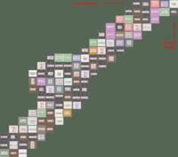
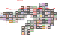
Here is my poor attempts to make a hand made map. This can be useful in some way, also, this region on my map is more more southier than Tikhon General Hospital. http://img395.imageshack.us/img395/5416/pylyuh5.gif --Pheen 11:28, 29 October 2008 (UTC)
Here's a quick & dirty merge of my map and Jen's, it gives us the full NE to SW diagonal. I'm not 100% sure about the southern limit cause I got it from the western side, but I'm pretty sure it's 33 blocks.--Zolt 11:59, 29 October 2008 (UTC)
October 28 2008
Let's get a map up here ASAP. --Willdobbins
- these 8 iwitty - done @ User:Duke Garland/BHW --~~~~ [talk] 22:17, 28 October 2008 (UTC)
Yes, I am pretty abandoning Malton. BWAHAHA!! MORE MAPPING!!--Jen 21:21, 28 October 2008 (UTC)
- Screenshot transcribed into the 22x22 map, thanks! --Tybalt Peroni 10:38, 29 October 2008 (UTC)
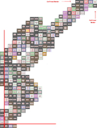
- I went roughly along the northern edge of Central BW, finishing in West BW. Now we can figure out that the width of Central Borehamwood is 22! (My map ties nicely into the suburb map below, connecting point is Monica General Hospital). --Tybalt Peroni 21:34, 28 October 2008 (UTC)
- This screenshot has now been transcribed onto the new 22x22 map, I'm going to do Jen's now. --Tybalt Peroni 10:01, 29 October 2008 (UTC)
--Let's try filling in the new map. I can easily edit the template if we find the suburb has different dimensions than 22x22--Brad Karlin
- I can't get Iwitness to work for me. If I post some screenshots is that going to help? Is there a page somewhere where all the mapping is being centralized? - tylerisfat 22:56, 28 October 2008 (UTC)
- A set of iwitness snapshots, walking south along the western border of Central BHW. I didn't get all the way to southwestern corner... Yet. --Tybalt Peroni 00:25, 29 October 2008 (UTC)
[1] [2] [3] [4] [5] [6] [7] [8] [9] [10] [11] [12] [13] [14] [15] [16] [17] [18] [19] [20]
- Finished the route to the SW corner. Height of Central BHW is 33. --Tybalt Peroni 11:10, 29 October 2008 (UTC)
[21] [22] [23] [24] [25] [26] [27] [28] [29] [30] [31] [32] [33] [34] [35]
Suburb Map
- This map has been transcribed to the bigger map below. Feel free to double-check after me and eventually remove it.
Suburb Map
--New 22x33 map.--
- Height of Central Borehamwood is in fact 33. I have added scouted locations below, but the template needs to be extended. --Tybalt Peroni 11:13, 29 October 2008 (UTC)
- I'd like to see your data. I suspect it's 36 in north-south dimension, combining my own observations with others. Would like to have the dimensions confirmed. -- Maunder 15:28, 29 October 2008 (UTC)
- Two independent people have counted 33, I think this is the correct height. My data consists of two sets of iwitness links listed higher up the page, and one screenshot I uploaded. The map below also contains data from screenshots linked here by other people. --Tybalt Peroni 16:12, 29 October 2008 (UTC)
- Yes, I agree. My combined map shows 33 squares vertical for west borehamwood. Yay! -- Maunder 17:45, 29 October 2008 (UTC)
- I'd like to see your data. I suspect it's 36 in north-south dimension, combining my own observations with others. Would like to have the dimensions confirmed. -- Maunder 15:28, 29 October 2008 (UTC)
I believe the map below has errors. The Akehurst Museum should be east of the Whitty Museum. -- Maunder 15:28, 29 October 2008 (UTC)
- Let's hope this is not the case - it would be quite painful to figure out what is wrong and what is right. The part you describe was entered based on the screenshot provided by Zolt today (see higher up the page, Image:CentralBorheam2.png). --Tybalt Peroni 16:13, 29 October 2008 (UTC)
- I am guessing my data was wrong, so I've corrected the few of my squares that did not agree with the pictures above. Thanks, it's lookin pretty good now! -- Maunder 18:23, 29 October 2008 (UTC)
- I think my map could have errors cause I had lots of problems getting and linking all the screenshots and some got missing, but I'm pretty sure about akehurst and Whitty cause it's where I started. It's confirmed by Jen's map and by Tybalt's iwitty n°17. -- Zolt 19:13, 29 October 2008
It definately 22 across by 33 down, managed to tie all the screenshots together and I have personally comfirmed the SW corner. If someone could get a grid up I could fill out the northern, southern and western borders. ~ alphastarre 29th oct 5pm
- I added a swath of blocks in the southwest to south-central part of the suburb. Any errors are mine. Hopefully someone can build off those to confirm the other borders. --- Frohlicker 11:29 CST, 29 October 2008
{{Borehamwood_Suburb|suburb=Central Borehamwood|
NW_Suburb=NW|
N_Suburb=North Borehamwood|
NE_Suburb=Northeast Borehamwood|
W_Suburb=W|
E_Suburb=East Borehamwood|
SW_Suburb=SW|
S_Suburb=S|
SE_Suburb=SE|
location0101=| location0102=| location0103=| location0104=| location0105=the Grice Museum|location0105_color=Museum| location0106=Carrott Square|location0106_color=Street| location0107=the Mallack Building|location0107_color=Building| location0108=Sheat Crescent|location0108_color=Street| location0109=Binney Towers|location0109_color=Tower| location0110=Brigid General Hospital|location0110_color=Hospital| location0111=Clack Road|location0111_color=Street| location0112=Club Cheek|location0112_color=Club| location0113=The Queen's Arms|location0113_color=Arms| location0114=Whitemarsh Avenue|location0114_color=Street| location0115=Bushrod Alley|location0115_color=Street| location0116=Tipper Street|location0116_color=Street| location0117=| location0118=| location0119=The Dean Monument|location0119_color=monument| location0120=Teresa General Hospital|location0120_color=hospital| location0121=The Dredge Building|location0121_color=building| location0122=Boucher Library|location0122_color=library| location0201=Teresa Square|location0201_color=street| location0202=Chetham Gardens|location0202_color=street| location0203=Tindell Bank|location0203_color=bank| location0204=Dear Walk|location0204_color=street| location0205=Burden Alley|location0205_color=street| location0206=the Willment Building|location0206_color=building| location0207=the Dodington Monument|location0207_color=monument| location0208=Rowson Street|location0208_color=street| location0209=Christopher Grove|location0209_color=street| location0210=St Christopher's Hospital|location0210_color=hospital| location0211=the Mellier Monument|location0211_color=monument| location0212=a factory|location0212_color=factory| location0213=Norgan Row|location0213_color=street| location0214=Ladner Crescent Fire Station|location0214_color=Fire Station| location0215=the Parham Building|location0215_color=building| location0216=wasteland|location0216_color=wasteland| location0217=Gamis Lane|location0217_color=street| location0218=a junkyard|location0218_color=junkyard| location0219=Buck Avenue|location0219_color=street| location0220=Club Webber|location0220_color=club| location0221=Fredrick Park|location0221_color=park| location0222=a carpark|location0222_color=carpark| location0301=The Tap and Spile|location0301_color=arms| location0302=Lenox Road Police Station|location0302_color=Police Dept| location0303=Sheppard Square|location0303_color=street| location0304=The Rising Sun|location0304_color=arms| location0305=Gammon Walk Police Station|location0305_color=Police Dept| location0306=The Pitcher Museum|location0306_color=museum| location0307=Whitcombe Walk|location0307_color=Street| location0308=| location0309=Bransom Gardens Fire Station|location0309_color=Fire Station| location0310=Paffard Alley|location0310_color=Street| location0311=Hagan Bank|location0311_color=Bank| location0312=Valentine Terrace Police Station|location0312_color=Police Dept| location0313=Budgen Crescent|location0313_color=Street| location0314=Edward Alley|location0314_color=Street| location0315=Justice Way Garage|location03015_color=Auto Repair| location0316=Alfred General Hospital|location0316_color=Hospital| location0317=Pierson Park|location0317_color=park| location0318=wasteland|location0318_color=wasteland| location0319=a carpark|location0319_color=carpark| location0320=Club Dewes|location0320_color=club| location0321=Care Towers|location0321_color=tower| location0322=Campain Road|location0322_color=street| location0401=Sires Street|location0401_color=street| location0402=the Clanfield Building|location0402_color=Building| location0403=Saltford Towers|location0403_color=Tower| location0404=wasteland|location0404_color=Wasteland| location0405=the Grimes Monument|location0405_color=Monument| location0406=the Goverd Building|location0406_color=Building| location0407=| location0408=| location0409=| location0410=the Prendergast Museum|location0410_color=Museum| location0411=Cowing Crescent|location0411_color=Street| location0412=Stephens Square|location0412_color=Street| location0413=Foxwell Grove|location0413_color=Street| location0414=Beater Park|location0414_color=Park| location0415=Club Grundy|location0415_color=Club| location0416=Helliar Square|location0416_color=street| location0417=Monica General Hostpital|location0417_color=hospital| location0418=Heathcote Road Fire Station|location0418_color=Fire Station| location0419=Bungay Cinema|location0419_color=cinema| location0420=Atwood Crescent|location0420_color=street| location0421=The Valentine Building|location0421_color=building| location0422=Marshalsey Bank|location0422_color=bank| location0501=Batt Walk|location0501_color=Street| location0502=the Chorley Hotel|location0502_color=Hotel| location0503=Snell Park|location0503_color=Park| location0504=Sellwood Place Fire Station|location0504_color=Fire Station| location0505=| location0506=| location0507=| location0508=Venables Bank|location0508_color=Bank| location0509=a factory|location0509_color=Factory| location0510=Wolsey Yard Fire Station|location0510_color=Fire Station| location0511=the Ditcher Hotel|location0511_color=Hotel| location0512=William General Hospital|location0512_color=Hospital| location0513=Rutt Road|location0513_color=Street| location0514=Greenway Grove|location0514_color=Street| location0515=Club Jarvie|location0515_color=Club| location0516=a warehouse|location0516_color=Warehouse| location0517=a petrol station|location0517_color=Factory| location0518=Club Hambridge|location0518_color=Club| location0519=Tikhon General Hospital|location0519_color=Hospital| location0520=Willy Square|location0520_color=Street| location0521=| location0522=| location0601=Membry Way|location0601_color=Street| location0602=the Tredaway Building|location0602_color=Building| location0603=| location0604=| location0605=| location0606=| location0607=Flower Street||location0607_color=street| location0608=Beaman Alley||location0608_color=street| location0609=The Lutman Museum||location0609_color=Museum| location0610=the Yandle Building|location0610_color=Building| location0611=Dunstan General Hospital|location0611_color=Hospital| location0612=St Agathius's Church|location0612_color=Church| location0613=a cemetery|location0613_color=Cemetery| location0614=Budgell Bank|location0614_color=Bank| location0615=Clitsome Cinema|location0615_color=Cinema| location0616=the Taplin Building|location0616_color=Building| location0617=Gait Way School|location0617_color=School| location0618=a carpark|location0618_color=Carpark| location0619=| location0620=| location0621=| location0622=| location0701=a warehouse|location0701_color=warehouse| location0702=Parkin Place Police Station|location0702_color=Police Dept| location0703=| location0704=| location0705=| location0706=wasteland||location0706_color=wasteland| location0707=a factory||location0707_color=factory| location0708=Syme Library||location0708_color=library| location0709=a junkyard||location0709_color=junkyard| location0710=Kempston Crescent Fire Station|location0710_color=Fire Station| location0711=Hounsell Court|location0711_color=Street| location0712=Hildebrand Grove|location0712_color=Street| location0713=the Driscoll Hotel|location0713_color=Hotel| location0714=Shelley Way Fire Station|location0714_color=Fire Station| location0715=Bhore Road|location0715_color=Street| location0716=Cazalet Road|location0716_color=Street| location0717=Prisk Road|location0717_color=Street| location0718=Atwood Yard| location0719=| location0720=| location0721=| location0722=| location0801=Eagan Road|location0801_color=street| location0802=Ruffer Towers|location0802_color=tower| location0803=| location0804=| location0805=Geddes Gardens||location0805_color=street| location0806=Porter Road||location0806_color=street| location0807=a factory||location0807_color=factory| location0808=Goodfellow Way||location0808_color=street| location0809=Hepplethwaite Park||location0809_color=Park| location0810=Barling Park|location0810_color=Park| location0811=the Adolphy Building|location0811_color=Building| location0812=Keyford Towers|location0812_color=Tower| location0813=Counter Road|location0813_color=Street| location0814=Hardie Grove|location0814_color=Street| location0815=The Running Horses|location0815_color=Arms| location0816=Callistus Street|location0816_color=Street| location0817=a junkyard|location0817_color=Junkyard| location0818=Birmingham Park|location0818_color=Park| location0819=| location0820=| location0821=| location0822=| location0901=wasteland|location0901_color=wasteland| location0902=a carpark|location0902_color=carpark| location0903=Club Camidge|location0903_color=club| location0904=wasteland|location0904_color=wasteland| location0905=wasteland|location0905_color=wasteland| location0906=Cunigunde General Hospital|location0906_color=hospital| location0907=Sprackling Yard Fire Station|location0907_color=Fire Station| location0908=Cridge Road|location0908_color=street| location0909=Donegan Lane|location0909_color=Street| location0910=Howes Square|location0910_color=Street| location0911=Head Avenue School|location0911_color=School| location0912=Ledamun Way|location0912_color=Street| location0913=The Queen's Head|location0913_color=Arms| location0914=Chinnick Lane|location0914_color=Street| location0915=| location0916=Roadnight Cinema|location0916_color=Cinema| location0917=the Bohin Building|location0917_color=Building| location0918=Molesworth Terrace|location0918_color=Street| location0919=| location0920=| location0921=| location0922=| location1001=Thom Street|location1001_color=Street| location1002=St. Onuphrius's Hospital|location1002_color=hospital| location1003=Broad Crescent|location1003_color=Street| location1004=Bobbett Road|location1004_color=Street| location1005=House Grove|location1005_color=Street| location1006=St. Servatius's Church|location1006_color=Church| location1007=Purt Avenue|location1007_color=Street| location1008=Hayler Gardens|location1008_color=Street| location1009=Briggs Library|location1009_color=Library| location1010=Hunn Road|location1010_color=Street| location1011=the Radcliffe Arms|location1011_color=Arms| location1012=Mallard Square Police Station|location1012_color=Police Dept| location1013=Marke Row|location1013_color=Street| location1014=the Lathey Building|location1014_color=Building| location1015=St. Antheros's Church|location1015_color=Church| location1016=a cemetery|location1016_color=Cemetery| location1017=Meetcham Lane Fire Station|location1017_color=Fire Station| location1018=| location1019=| location1020=| location1021=| location1022=| location1101=wasteland|location1101_color=Wasteland| location1102=Roles Library|location1102_color=Library| location1103=Helland Grove|location1103_color=Street| location1104=the Leo Building|location1104_color=Building| location1105=Lancey Museum|location1105_color=Museum| location1106=The Load of Hay|location1106_color=Arms| location1107=Club Wyke|location1107_color=Club| location1108=Shortis Way School|location1108_color=School| location1109=Hylton Lane Garage|location1109_color=Auto Repair| location1110=Hook Bank|location1110_color=Bank| location1111=wasteland|location1111_color=Wasteland| location1112=Wyche Way|location1112_color=Street| location1113=Quaney Terrace| location1114=Canning Lane|location1114_color=Street| location1115=Mist Way|location1115_color=Street| location1116=the Healey Building|location1116_color=Building| location1117=Madill Cinema|location1117_color=Cinema| location1118=| location1119=| location1120=| location1121=| location1122=| location1201=Buckler Way School|location1201_color=School| location1202=the Marriage Building|location1202_color=Building| location1203=Lucius General Hospital|location1203_color=hospital| location1204=Rawlings Towers|location1204_color=Tower| location1205=the Elsworth Monument|location1205_color=Monument| location1206=wasteland|location1206_color=Wasteland| location1207=Sorrell Square|location1207_color=Street| location1208=Corbin Way Police Station|location1208_color=Police Dept| location1209=Cattle Way School|location1209_color=School| location1210=the Anstey Monument|location1210_color=Monument| location1211=Jesse Way|location1211_color=Street| location1212=Haslock Square|location1212_color=Street| location1213=Meacham Crescent Fire Station|location1213_color=Fire Station| location1214=the Verrier Hotel|location1214_color=Hotel| location1215=Pilkington Way School|location1215_color=School| location1216=| location1217=| location1218=| location1219=| location1220=| location1221=| location1222=| location1301=| location1302=Minife Crescent Fire Station|location1302_color=Fire Station| location1303=wasteland|location1303_color=wasteland| location1304=The Amos Building|location1304_color=building| location1305=The Pears Building|location1305_color=building| location1306=Pavitt Cinema|location1306_color=cinema| location1307=Waugh Grove|location1307_color=Street| location1308=Perace Avenue|location1308_color=Street| location1309=Furneaux Way|location1309_color=Street| location1310=wasteland|location1310_color=Wasteland| location1311=Sankey Street|location1311_color=Street| location1312=Neot Avenue|location1312_color=Street| location1313=St Vincents Hospital|location1313_color=Hospital| location1314=a junkyard|location1314_color=Junkyard| location1315=wasteland|location1315_color=Wasteland| location1316=| location1317=| location1318=| location1319=| location1320=| location1321=| location1322=| location1401=Farrant Gardens|location1401_color=street| location1402=St Faustina's Hospital|location1402_color=hospital| location1403=The Cockell Building|location1403_color=building| location1404=Chandler Towers|location1404_color=tower| location1405=The London Building|location1405_color=building| location1406=| location1407=Tagg Way Fire Station|location1407_color=Fire Station| location1408=a factory|location1408_color=Factory| location1409=Hinuber Way|location1409_color=Street| location1410=Scully Bank|location1410_color=Bank| location1411=Dobson Avenue Police Station|location1411_color=Police Dept| location1412=| location1413=| location1414=| location1415=| location1416=| location1417=| location1418=| location1419=| location1420=| location1421=| location1422=| location1501=Grannum Gardens|location1501_color=street| location1502=Gidley Walk Fire Station|location1502_color=Fire Station| location1503=Club Ransford|location1503_color=club| location1504=Sturges Square|location1504_color=street| location1505=| location1506=Passmore Alley Garage|location1506_color=Auto Repair| location1507=Hamlin Park|location1507_color=Park| location1508=wasteland|location1508_color=Wasteland| location1509=Foan Square|location1509_color=Street| location1510=the Sealy Hotel|location1510_color=Hotel| location1511=| location1512=| location1513=| location1514=| location1515=| location1516=| location1517=| location1518=| location1519=| location1520=| location1521=| location1522=| location1601=Wills Grove|location1601_color=street| location1602=a carpark|location1602_color=carpark| location1603=The Dodd Hotel|location1603_color=hotel| location1604=| location1605=the Cowgall Museum|location1605_color=Museum| location1606=Denham Gardens|location1606_color=Monument| location1607=wasteland|location1607_color=Wasteland| location1608=wasteland|location1608_color=Wasteland| location1609=Fray Bank|location1609_color=Bank| location1610=| location1611=| location1612=| location1613=| location1614=| location1615=| location1616=| location1617=| location1618=| location1619=| location1620=| location1621=| location1622=| location1701=Shaw Road|location1701_color=street| location1702=Talbot Gardens|location1702_color=street| location1703=| location1704=Burbidge Place Fire Station|location1704_color=Fire Station| location1705=Marcellus Cinema|location1705_color=Cinema| location1706=Wanstall Bank|location1706_color=Bank| location1707=a warehouse|location1707_color=Warehouse| location1708=wasteland|location1708_color=Wasteland| location1709=| location1710=| location1711=| location1712=| location1713=| location1714=| location1715=| location1716=| location1717=| location1718=| location1719=| location1720=| location1721=| location1722=| location1801=Kirby Place|location1801_color=street| location1802=Farrel Street|location1802_color=Street| location1803=Stark Alley|location1803_color=Street| location1804=Shortis Street|location1804_color=Street| location1805=wasteland|location1805_color=Wasteland| location1806=Cope Crescent|location1806_color=Street| location1807=Dodimead Avenue School|location1807_color=School| location1808=| location1809=| location1810=| location1811=| location1812=| location1813=| location1814=| location1815=| location1816=| location1817=| location1818=| location1819=| location1820=| location1821=| location1822=a warehouse|location1822_color=warehouse| location1901=the Denney Building|location1901_color=Building| location1902=the Whitty Museum|location1902_color=Museum| location1903=Burd Avenue|location1903_color=Street| location1904=Nicols Cinema|location1904_color=Cinema| location1905=Marton Avenue|location1905_color=Street| location1906=The Moon on the Hill|location1906_color=Arms| location1907=| location1908=| location1909=| location1910=| location1911=| location1912=| location1913=| location1914=| location1915=| location1916=| location1917=| location1918=| location1919=| location1920=| location1921=wasteland|location1921_color=wasteland| location1922=Bethell Crescent|location1922_color=street| location2001=the Webbey Building|location2001_color=Building| location2002=the Higdon Museum|location2002_color=Museum| location2003=the Akehurst Museum|location2003_color=Museum| location2004=a junkyard|location2004_color=Junkyard| location2005=Milard Towers|location2005_color=Tower| location2006=| location2007=| location2008=| location2009=| location2010=| location2011=| location2012=| location2013=| location2014=| location2015=| location2016=| location2017=| location2018=| location2019=| location2020=Clavel Road|location2020_color=street| location2021=The Plough|location2021_color=arms| location2022=the Andow Building|location2022_color=building| location2101=the Elton Building|location2101_color=Building| location2102=Gelasius Bank|location2102_color=Bank| location2103=Mayer Row|location2103_color=Street| location2104=Polycarp Terrace|location2104_color=Street| location2105=Walling Square|location2015_color=Street| location2106=Sawtell Alley|location2106_color=Street| location2107=| location2108=| location2109=| location2110=| location2111=| location2112=| location2113=| location2114=| location2115=| location2116=| location2117=| location2118=| location2119=the Dahoney Building|location2119_color=building| location2120=wasteland|location2120_color=wasteland| location2121=Edridge Towers|location2121_color=tower| location2122=the Marcus Hotel|location2122_color=hotel| location2201=Cheffe Crescent|location2201_color=Street| location2202=Shiplow Towers|location2202_color=Tower| location2203=Mallett Row|location2203_color=Street| location2204=Vicarage Park|location2204_color=Park| location2205=wasteland|location2205_color=Wasteland| location2206=Woodthorpe Row|location2206_color=Street| location2207=a warehouse|location2207_color=Warehouse| location2208=| location2209=| location2210=| location2211=| location2212=| location2213=| location2214=| location2215=| location2216=| location2217=| location2218=| location2219=a factory|location2219_color=factory| location2220=Bioletti Road|location2220_color=street| location2221=Mannings Road|location2221_color=street| location2222=The Shepherd's Hall|location2222_color=arms| location2301=The Carpenters Arms|location2301_color=arms| location2302=Mumford Avenue|location2302_color=street| location2303=Cardwell Bank|location2303_color=bank| location2304=Gilbert Way|location2304_color=street| location2305=| location2306=| location2307=| location2308=| location2309=| location2310=| location2311=| location2312=| location2313=Woodland Grove Garage|location2313_color=Auto Repair| location2314=Wickett Court|location2314_color=street| location2315=the Bastard Monument|location2315_color=monument| location2316=| location2317=| location2318=| location2319=the Semple Towers|location2319_color=tower| location2320=The Pig and Fiddle|location2320_color=arms| location2321=Tayler Library|location2321_color=library| location2322=Jearum Way|location2322_color=street| location2401=Bickle Ave.|location2401_color=street| location2402=Monks walk|location2402_color=street| location2403=| location2404=| location2405=| location2406=| location2407=| location2408=| location2409=| location2410=| location2411=| location2412=wasteland|location2412_color=Wasteland| location2413=Burchill Lane|location2413_color=Street| location2414=Gwinnall Place|location2414_color=Street| location2415=a carpark|location2415_color=carpark| location2416=| location2417=| location2418=| location2419=| location2420=Finch Alley|location2420_color=street| location2421=Kerridge Towers|location2421_color=tower| location2422=Lacey Walk|location2422_color=street| location2501=Preller Bank|location2501_color=bank| location2502=a warehouse|location2502_color=warehouse| location2503=| location2504=| location2505=| location2506=| location2507=wasteland|location2507_color=Wasteland| location2508=Ley Square|location2508_color=street| location2509=Parkhouse Grove School|location2509_color=School| location2510=| location2511=the Woodham Building|location2511_color=building| location2512=the Feltham Hotel|location2512_color=hotel| location2513=Club Belsten|location2513_color=club| location2514=Glyde Street|location2514_color=street| location2515=the Spry Building|location2515_color=building| location2516=| location2517=| location2518=| location2519=| location2520=the McKinnon Monument|location2520_color=monument| location2521=Ponder Park|location2521_color=park| location2522=a carpark|location2522_color=carpark| location2601=the Matheous Monument|location2601_color=monument| location2602=Seekins Square|location2602_color=street| location2603=| location2604=| location2605=| location2606=the Klimer Building|location2606_color=building| location2607=Scallon Library|location2607_color=Library| location2608=Club Sinclair|location2608_color=club| location2609=Knollys Library|location2609_color=Library| location2610=the Callender Hotel|location2610_color=hotel| location2611=Stitson Gardens|location2611_color=Street| location2612=Club Wornel|location2612_color=club| location2613=Club Sutton|location2613_color=club| location2614=the Wistow Museum|location2614_color=Museum| location2615=| location2616=| location2617=| location2618=| location2619=| location2620=a factory|location2620_color=factory| location2621=the Simper Museum|location2621_color=museum| location2622=Bragge Alley|location2622_color=street| location2701=Harenc Row Fire Station|location2701_color=Fire Station| location2702=Wiseman Grv.|location2702_color=street| location2703=Hailleley Way|location2703_color=Street| location2704=Hutchins Row Fire Station|location2704_color=Fire Station| location2705=Dorrington Way|location2705_color=Street| location2706=wasteland|location2706_color=Wasteland| location2707=Skilton Street|location2707_color=Street| location2708=the Sulley Building|location2708_color=building| location2709=Deed Crescent|location2709_color=Street| location2710=Cowlin Road|location2710_color=Street| location2711=Urban Row Police Station|location2711_color=Police Dept| location2712=Edward Crescent Garage|location2712_color=Auto Repair| location2713=Dodimead Library|location2713_color=Library| location2714=| location2715=| location2716=| location2717=| location2718=| location2719=| location2720=| location2721=The Princess Royal|location2721_color=arms| location2722=the Phillipps Building|location2722_color=building| location2801=Club Pooll|location2801_color=club| location2802=wasteland|location2802_color=wasteland| location2803=Dunstone Square|location2803_color=Street| location2804=Giverd Street|location2804_color=Street| location2805=Comber Crescent|location2805_color=Street| location2806=Fish Lane|location2806_color=Street| location2807=a warehouse|location2807_color=Warehouse| location2808=a carpark|location2808_color=carpark| location2809=Moorhouse Alley|location2809_color=Street| location2810=St. Bartholomew's Hospital|location2810_color=hospital| location2811=Whatmore Grove Garage|location2811_color=Auto Repair| location2812=Cooke Crescent|location2812_color=Street| location2813=| location2814=| location2815=| location2816=| location2817=| location2818=| location2819=| location2820=Pilgrim Park|location2820_color=park| location2821=Dinwiddy Road|location2821_color=street| location2822=Sirl Library|location2822_color=library| location2901=Wayper Grv.|location2901_color=street| location2902=Stovin Library|location2902_color=library| location2903=wasteland|location2903_color=Wasteland| location2904=a carpark|location2904_color=carpark| location2905=the Sillence Building|location2905_color=building| location2906=Moreby Avenue|location2906_color=Street| location2907=Club Talbot|location2907_color=club| location2908=The Castle|location2908_color=Arms| location2909=the Androwes Building|location2909_color=building| location2910=Kidner Avenue|location2910_color=Street| location2911=| location2912=| location2913=| location2914=| location2915=| location2916=| location2917=| location2918=| location2919=| location2920=the Saunders Building|location2920_color=building| location2921=Club Ludlam|location2921_color=club| location2922=the Winstow Building|location2922_color=building| location3001=A Carpark|location3001_color=Carpark| location3002=Shutler Bank|location3002_color=Bank| location3003=Aelred General Hospital|location3003_color=Hospital| location3004=the Low Museum|location3004_color=Museum| location3005=a factory|location3005_color=Factory| location3006=Alberic Crescent|location3006_color=Street| location3007=Chaffe Library|location3007_color=Library| location3008=Shorey Walk Police Station|location3008_color=Police Dept| location3009=The Mother's Tavern|location3009_color=Arms| location3010=The Attle Museum|location3010_color=Museum| location3011=| location3012=| location3013=| location3014=| location3015=| location3016=| location3017=| location3018=| location3019=| location3020=Healy Library|location3020_color=Library| location3021=Bird Bank|location3021_color=Bank| location3022=The Talbot|location3022_color=Arms| location3101=Dorvell Cinema|location3101_color=Cinema| location3102=Wasteland|location3102_color=Wasteland| location3103=the Acourt Monument|location3103_color=Monument| location3104=Whitelock Avenue|location3104_color=Street| location3105=a petrol station|location3105_color=Auto Repair| location3106=the Limberye Building|location3106_color=Building| location3107=Meaden Street School|location3107_color=School| location3108=The Coach and Horses|location3108_color=Arms| location3109=Cook Street School|location3109_color=School| location3110=Stidston Lane|location3110_color=Street| location3111=| location3112=| location3113=| location3114=| location3115=| location3116=| location3117=| location3118=| location3119=| location3120=| location3121=Meleady Avenue|location3121_color=Street| location3122=Malby Alley School|location3122_color=School| location3201=The City Tavern|location3201_color=Arms| location3202=wasteland|location3202_color=Wasteland| location3203=| location3204=| location3205=| location3206=a warehouse|location3206_color=Warehouse| location3207=Venner Way|location3207_color=Street| location3208=Parden Road|location3208_color=Street| location3209=Sellwood Cinema|location3209_color=Cinema| location3210=Croom Walk|location3210_color=Street| location3211=| location3212=| location3213=| location3214=| location3215=| location3216=| location3217=| location3218=| location3219=| location3220=a petrol station|location3220_color=Auto Repair| location3221=Doe Alley|location3221_color=Street| location3222=the Willibrord Building|location3222_color=Building| location3301=a petrol station|location3301_color=Auto Repair| location3302=Josaphat General Hospital|location3302_color=Hospital| location3303=Thornton Way|location3303_color=Street| location3304=The Cable Museum|location3304_color=Museum| location3305=Club Barter|location3305_color=Club| location3306=the Holt Hotel|location3306_color=Hotel| location3307=a factory|location3307_color=Factory| location3308=St. Cyril's Church|location3308_color=Church| location3309=a junkyard|location3309_color=Junkyard| location3310=| location3311=| location3312=| location3313=| location3314=| location3315=| location3316=| location3317=| location3318=| location3319=a junkyard|location3319_color=junkyard| location3320=Stagg Library|location3320_color=library| location3321=St Alban's Church|location3321_color=church| location3322=wasteland|location3322_color=wasteland|


