Pegrum Square Fire Station: Difference between revisions
From The Urban Dead Wiki
Jump to navigationJump to search
No edit summary |
|||
| Line 2: | Line 2: | ||
==Info== | ==Info== | ||
{{Locationblock| | |||
suburb=Roachtown| | |||
coordinates=55, 37| | |||
NW_location=[[McCann Lane]]|NW_color=Street| | |||
N_location=[[The Scott Motel]]|N_color=Motel| | |||
NE_location=[[the Spinks Monument]]|NE_color=Monument| | |||
W_location=[[Bayfield Drive]]|W_color=street| | |||
This_location=Gore Lane|location_color=Fire Station| | |||
location_type=Fire Station| | |||
E_location=[[Stiles Row]]|E_color=Street| | |||
SW_location=[[Slape Way School]]|SW_color=School| | |||
S_location=[[Gore Lane]]|S_color=Street| | |||
SE_location=[[Wasteland 56,38|Wasteland]]|SE_color=Wasteland|}} | |||
*Pegrum Square Fire Station is found in South Central [[Roachtown]], just one block west of the ill-famed [[Roachtown ghettos]]. | *Pegrum Square Fire Station is found in South Central [[Roachtown]], just one block west of the ill-famed [[Roachtown ghettos]]. | ||
Revision as of 03:28, 3 January 2009
Pegrum Square Fire Station
Info
| Gore Lane
Roachtown [55, 37]
Basic Info:
|
- Pegrum Square Fire Station is found in South Central Roachtown, just one block west of the ill-famed Roachtown ghettos.
Location
[55, 37]
Current Condition
- Ransacked and wide open. 05:50, 13 January 2008 (UTC)
- Station is clear and very strongly barricaded. Multiple zombies in the area, enter with extreme caution! (Dec. 14th, 9:00pm EST)
- A mysterious person dressed impecabbly arrived here observing markings left on this old firehouse. (Feb. 18th, 9:42pm EST)
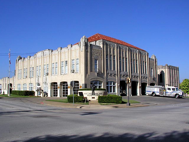
- Photo taken taken some time before infestation.
| This page, Pegrum Square Fire Station, is a locations stub. Please help us to improve the wiki by contributing to this page. Be sure the following information is added to the page: coordinates, suburb, 9 block map (or 16 block map for large buildings), description, barricading policy, and history. Please refer to the Location Style Guide. |
