Central Borehamwood: Difference between revisions
Brad Karlin (talk | contribs) No edit summary |
Holtzfeller (talk | contribs) m (→Suburb Map) |
||
| Line 214: | Line 214: | ||
location0119=[[The Dean Monument]]|location0119_color=monument| | location0119=[[The Dean Monument]]|location0119_color=monument| | ||
location0120=[[Teresa General Hospital]]|location0120_color=hospital| | location0120=[[Teresa General Hospital]]|location0120_color=hospital| | ||
location0121=[[ | location0121=[[the Dredge Building]]|location0121_color=building| | ||
location0122=[[Boucher Library]]|location0122_color=library| | location0122=[[Boucher Library]]|location0122_color=library| | ||
location0201=[[Teresa Square]]|location0201_color=street| | location0201=[[Teresa Square]]|location0201_color=street| | ||
| Line 222: | Line 222: | ||
location0205=[[Burden Alley]]|location0205_color=street| | location0205=[[Burden Alley]]|location0205_color=street| | ||
location0206=[[the Willment Building]]|location0206_color=building| | location0206=[[the Willment Building]]|location0206_color=building| | ||
location0207=[[ | location0207=[[The Dodington Monument]]|location0207_color=monument| | ||
location0208=[[Rowson Street]]|location0208_color=street| | location0208=[[Rowson Street]]|location0208_color=street| | ||
location0209=[[Christopher Grove]]|location0209_color=street| | location0209=[[Christopher Grove]]|location0209_color=street| | ||
| Line 243: | Line 243: | ||
location0304=[[The Rising Sun]]|location0304_color=arms| | location0304=[[The Rising Sun]]|location0304_color=arms| | ||
location0305=[[Gammon Walk Police Station]]|location0305_color=Police Dept| | location0305=[[Gammon Walk Police Station]]|location0305_color=Police Dept| | ||
location0306=[[ | location0306=[[the Pitcher Museum]]|location0306_color=museum| | ||
location0307=[[Whitcombe Walk]]|location0307_color=Street| | location0307=[[Whitcombe Walk]]|location0307_color=Street| | ||
location0308=| | location0308=| | ||
| Line 384: | Line 384: | ||
location0913=[[The Queen's Head]]|location0913_color=Arms| | location0913=[[The Queen's Head]]|location0913_color=Arms| | ||
location0914=[[Chinnick Lane]]|location0914_color=Street| | location0914=[[Chinnick Lane]]|location0914_color=Street| | ||
location0915=| | location0915=[[St Patriarch's Church]]|location0915_color-Church| | ||
location0916=[[Roadnight Cinema]]|location0916_color=Cinema| | location0916=[[Roadnight Cinema]]|location0916_color=Cinema| | ||
location0917=[[the Bohin Building]]|location0917_color=Building| | location0917=[[the Bohin Building]]|location0917_color=Building| | ||
| Line 397: | Line 397: | ||
location1004=[[Bobbett Road]]|location1004_color=Street| | location1004=[[Bobbett Road]]|location1004_color=Street| | ||
location1005=[[House Grove]]|location1005_color=Street| | location1005=[[House Grove]]|location1005_color=Street| | ||
location1006=[[St | location1006=[[St Servatius's Church]]|location1006_color=Church| | ||
location1007=[[Purt Avenue]]|location1007_color=Street| | location1007=[[Purt Avenue]]|location1007_color=Street| | ||
location1008=[[Hayler Gardens]]|location1008_color=Street| | location1008=[[Hayler Gardens]]|location1008_color=Street| | ||
| Line 406: | Line 406: | ||
location1013=[[Marke Row]]|location1013_color=Street| | location1013=[[Marke Row]]|location1013_color=Street| | ||
location1014=[[the Lathey Building]]|location1014_color=Building| | location1014=[[the Lathey Building]]|location1014_color=Building| | ||
location1015=[[St | location1015=[[St Antheros's Church]]|location1015_color=Church| | ||
location1016=[[a cemetery]]|location1016_color=Cemetery| | location1016=[[a cemetery]]|location1016_color=Cemetery| | ||
location1017=[[Meetcham Lane Fire Station]]|location1017_color=Fire Station| | location1017=[[Meetcham Lane Fire Station]]|location1017_color=Fire Station| | ||
| Line 418: | Line 418: | ||
location1103=[[Helland Grove]]|location1103_color=Street| | location1103=[[Helland Grove]]|location1103_color=Street| | ||
location1104=[[the Leo Building]]|location1104_color=Building| | location1104=[[the Leo Building]]|location1104_color=Building| | ||
location1105=[[Lancey Museum]]|location1105_color=Museum| | location1105=[[the Lancey Museum]]|location1105_color=Museum| | ||
location1106=[[The Load of Hay]]|location1106_color=Arms| | location1106=[[The Load of Hay]]|location1106_color=Arms| | ||
location1107=[[Club Wyke]]|location1107_color=Club| | location1107=[[Club Wyke]]|location1107_color=Club| | ||
| Line 458: | Line 458: | ||
location1221=| | location1221=| | ||
location1222=| | location1222=| | ||
location1301=| | location1301=[[the Calland Bilding]]|location1301_color=Building| | ||
location1302=[[ | location1302=[[Minifie Crescent Fire Station]]|location1302_color=Fire Station| | ||
location1303=[[wasteland]]|location1303_color=wasteland| | location1303=[[wasteland]]|location1303_color=wasteland| | ||
location1304=[[The Amos Building]]|location1304_color=building| | location1304=[[The Amos Building]]|location1304_color=building| | ||
| Line 520: | Line 520: | ||
location1517=[[Eaves Square]]|location1517_color=street| | location1517=[[Eaves Square]]|location1517_color=street| | ||
location1518=[[Bayford Gardens]]|location1518_color=street| | location1518=[[Bayford Gardens]]|location1518_color=street| | ||
location1519=[[St | location1519=[[St Edward's Church]]|location1519_color=church| | ||
location1520=| | location1520=| | ||
location1521=| | location1521=| | ||
| Line 587: | Line 587: | ||
location1818=[[Cradock Gardens]]|location1818_color=street| | location1818=[[Cradock Gardens]]|location1818_color=street| | ||
location1819=[[Studham Square]]|location1819_color=street| | location1819=[[Studham Square]]|location1819_color=street| | ||
location1820=[[St | location1820=[[St Patrick's Church]]|location_color=church| | ||
location1821=[[Woodham Library]]|location1821_color=library| | location1821=[[Woodham Library]]|location1821_color=library| | ||
location1822=[[a warehouse]]|location1822_color=warehouse| | location1822=[[a warehouse]]|location1822_color=warehouse| | ||
| Line 700: | Line 700: | ||
location2321=[[Tayler Library]]|location2321_color=library| | location2321=[[Tayler Library]]|location2321_color=library| | ||
location2322=[[Jearum Way]]|location2322_color=street| | location2322=[[Jearum Way]]|location2322_color=street| | ||
location2401=[[Bickle | location2401=[[Bickle Avenue]]|location2401_color=street| | ||
location2402=[[Monks | location2402=[[Monks Walk]]|location2402_color=street| | ||
location2403=| | location2403=| | ||
location2404=| | location2404=| | ||
| Line 767: | Line 767: | ||
location2622=[[Bragge Alley]]|location2622_color=street| | location2622=[[Bragge Alley]]|location2622_color=street| | ||
location2701=[[Harenc Row Fire Station]]|location2701_color=Fire Station| | location2701=[[Harenc Row Fire Station]]|location2701_color=Fire Station| | ||
location2702=[[Wiseman | location2702=[[Wiseman Grove]]|location2702_color=street| | ||
location2703=[[Hailleley Way]]|location2703_color=Street| | location2703=[[Hailleley Way]]|location2703_color=Street| | ||
location2704=[[Hutchins Row Fire Station]]|location2704_color=Fire Station| | location2704=[[Hutchins Row Fire Station]]|location2704_color=Fire Station| | ||
| Line 810: | Line 810: | ||
location2821=[[Dinwiddy Road]]|location2821_color=street| | location2821=[[Dinwiddy Road]]|location2821_color=street| | ||
location2822=[[Sirl Library]]|location2822_color=library| | location2822=[[Sirl Library]]|location2822_color=library| | ||
location2901=[[Wayper | location2901=[[Wayper Grove]]|location2901_color=street| | ||
location2902=[[Stovin Library]]|location2902_color=library| | location2902=[[Stovin Library]]|location2902_color=library| | ||
location2903=[[wasteland]]|location2903_color=Wasteland| | location2903=[[wasteland]]|location2903_color=Wasteland| | ||
| Line 855: | Line 855: | ||
location3022=[[The Talbot]]|location3022_color=Arms| | location3022=[[The Talbot]]|location3022_color=Arms| | ||
location3101=[[Dorvell Cinema]]|location3101_color=Cinema| | location3101=[[Dorvell Cinema]]|location3101_color=Cinema| | ||
location3102=[[ | location3102=[[wasteland]]|location3102_color=Wasteland| | ||
location3103=[[the Acourt Monument]]|location3103_color=Monument| | location3103=[[the Acourt Monument]]|location3103_color=Monument| | ||
location3104=[[Whitelock Avenue]]|location3104_color=Street| | location3104=[[Whitelock Avenue]]|location3104_color=Street| | ||
| Line 879: | Line 879: | ||
location3202=[[wasteland]]|location3202_color=Wasteland| | location3202=[[wasteland]]|location3202_color=Wasteland| | ||
location3203=[[Old Grove]]|location3203_color=street| | location3203=[[Old Grove]]|location3203_color=street| | ||
location3204=[[ | location3204=[[Haldecote Square]]|location3204_color=street| | ||
location3205=[[The Dewell]]|location3205_color=building| | location3205=[[The Dewell]]|location3205_color=building| | ||
location3206=[[a warehouse]]|location3206_color=Warehouse| | location3206=[[a warehouse]]|location3206_color=Warehouse| | ||
| Line 887: | Line 887: | ||
location3210=[[Croom Walk]]|location3210_color=Street| | location3210=[[Croom Walk]]|location3210_color=Street| | ||
location3211=[[Club Bennetts]]|location3211_color=club| | location3211=[[Club Bennetts]]|location3211_color=club| | ||
location3212=[[St | location3212=[[St Zephyrinius church]]|location3212_color=church| | ||
location3213=[[Cemetery]]|location3213_color=cemetery| | location3213=[[Cemetery]]|location3213_color=cemetery| | ||
location3214=[[Trickwalk PD]]|location3214_color=Police Dept| | location3214=[[Trickwalk PD]]|location3214_color=Police Dept| | ||
location3215=[[Emelia]]|location3215_color=hospital| | location3215=[[Emelia]]|location3215_color=hospital| | ||
location3216=[[Isidore Bank]]|location3216_color=Bank| | location3216=[[Isidore Bank]]|location3216_color=Bank| | ||
location3217=[[ | location3217=[[the Ripley Building]]|location3217_color=building| | ||
location3218=| | location3218=| | ||
location3219=[[ | location3219=[[the Rollings Building]]|location3219_color=Building| | ||
location3220=[[a petrol station]]|location3220_color=Auto Repair| | location3220=[[a petrol station]]|location3220_color=Auto Repair| | ||
location3221=[[Doe Alley]]|location3221_color=Street| | location3221=[[Doe Alley]]|location3221_color=Street| | ||
| Line 901: | Line 901: | ||
location3302=[[Josaphat General Hospital]]|location3302_color=Hospital| | location3302=[[Josaphat General Hospital]]|location3302_color=Hospital| | ||
location3303=[[Thornton Way]]|location3303_color=Street| | location3303=[[Thornton Way]]|location3303_color=Street| | ||
location3304=[[ | location3304=[[the Cable Museum]]|location3304_color=Museum| | ||
location3305=[[Club Barter]]|location3305_color=Club| | location3305=[[Club Barter]]|location3305_color=Club| | ||
location3306=[[the Holt Hotel]]|location3306_color=Hotel| | location3306=[[the Holt Hotel]]|location3306_color=Hotel| | ||
location3307=[[a factory]]|location3307_color=Factory| | location3307=[[a factory]]|location3307_color=Factory| | ||
location3308=[[St | location3308=[[St Cyril's Church]]|location3308_color=Church| | ||
location3309=[[a junkyard]]|location3309_color=Junkyard| | location3309=[[a junkyard]]|location3309_color=Junkyard| | ||
location3310=[[Spear | location3310=[[Spear Library]]|location3310_color=library| | ||
location3311=[[Noblett | location3311=[[Noblett Walk Garage]]|location3311_color=auto Repair| | ||
location3312=[[St Hermans | location3312=[[St Hermans Hospital]]|location3312_color=hospital| | ||
location3313=[[Churchey | location3313=[[Churchey Lane]]|location3313_color=street| | ||
location3314=[[The Esain Building]]|location3314_color=building| | location3314=[[The Esain Building]]|location3314_color=building| | ||
location3315=[[wasteland]]|location3315_color=wasteland| | location3315=[[wasteland]]|location3315_color=wasteland| | ||
location3316=[[Warehouse]]|location3316_color=warehouse| | location3316=[[Warehouse]]|location3316_color=warehouse| | ||
location3317=[[Pulsford Terrace]]|location3317_color=street| | location3317=[[Pulsford Terrace]]|location3317_color=street| | ||
location3318=[[ | location3318=[[the Ramsden Monument]]|location3318_color=monument| | ||
location3319=[[a junkyard]]|location3319_color=junkyard| | location3319=[[a junkyard]]|location3319_color=junkyard| | ||
location3320=[[Stagg Library]]|location3320_color=library| | location3320=[[Stagg Library]]|location3320_color=library| | ||
location3321=[[St Alban's Church]]|location3321_color=church| | location3321=[[St Alban's Church]]|location3321_color=church| | ||
location3322=[[wasteland]]|location3322_color=wasteland}} | location3322=[[wasteland]]|location3322_color=wasteland}} | ||
Revision as of 22:46, 1 November 2008
| Region of Central Borehamwood | |||||||||||||||||||||||
| |||||||||||||||||||||||
| Update Central Borehamwood's Danger Level | |||||||||||||||||||||||
Known groups in this region:
| |||||||||||||||||||||||
| Phone Mast: |

|
Please remember to keep this article neutral. |
Central Borehamwood is a suburb of Borehamwood.
Resource Buildings
|
Fire Stations
|
Hospitals
|
|
Police Stations
| |
|
Shopping Centres |
Billboards |
Paynterton Radio
Recent News
Please: recent news at the top (signed & NPOV). Old news can be archived.
October 2008
31 October 2008
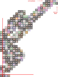
I posted these Iwittys on the Eastern Borehamwood page, but I'll post them here as well. These are confirmation of Central Borehamwood's NE and SE corners.
The Northeast corner: North Central Northeast East
The Southeast Corner: Central South East Southeast
--Zarneverfike 07:04, 31 October 2008 (UTC)
Here is a java source code file that can be used to create map templates of dimensions x by y from the console/terminal. Any improvements highly appreciated. (You'll need a java compiler to run.) [1] --Quicksivlerzxc 14:17, 31 October 2008 (UTC)
October 29 2008
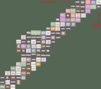
Here is my poor attempts to make a hand made map. This can be useful in some way, also, this region on my map is more more southier than Tikhon General Hospital. http://img395.imageshack.us/img395/5416/pylyuh5.gif --Pheen 11:28, 29 October 2008 (UTC)
Here's a quick & dirty merge of my map and Jen's, it gives us the full NE to SW diagonal. I'm not 100% sure about the southern limit cause I got it from the western side, but I'm pretty sure it's 33 blocks.--Zolt 11:59, 29 October 2008 (UTC)
October 28 2008
Let's get a map up here ASAP. --Willdobbins
- these 8 iwitty - done @ User:Duke Garland/BHW --~~~~ [talk] 22:17, 28 October 2008 (UTC)
Yes, I am pretty abandoning Malton. BWAHAHA!! MORE MAPPING!!--Jen 21:21, 28 October 2008 (UTC)
- Screenshot transcribed into the 22x22 map, thanks! --Tybalt Peroni 10:38, 29 October 2008 (UTC)
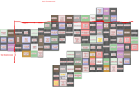
- I went roughly along the northern edge of Central BW, finishing in West BW. Now we can figure out that the width of Central Borehamwood is 22! (My map ties nicely into the suburb map below, connecting point is Monica General Hospital). --Tybalt Peroni 21:34, 28 October 2008 (UTC)
- This screenshot has now been transcribed onto the new 22x22 map, I'm going to do Jen's now. --Tybalt Peroni 10:01, 29 October 2008 (UTC)
--Let's try filling in the new map. I can easily edit the template if we find the suburb has different dimensions than 22x22--Brad Karlin
- I can't get Iwitness to work for me. If I post some screenshots is that going to help? Is there a page somewhere where all the mapping is being centralized? - tylerisfat 22:56, 28 October 2008 (UTC)
- A set of iwitness snapshots, walking south along the western border of Central BHW. I didn't get all the way to southwestern corner... Yet. --Tybalt Peroni 00:25, 29 October 2008 (UTC)
[2] [3] [4] [5] [6] [7] [8] [9] [10] [11] [12] [13] [14] [15] [16] [17] [18] [19] [20] [21]
- Finished the route to the SW corner. Height of Central BHW is 33. --Tybalt Peroni 11:10, 29 October 2008 (UTC)
[22] [23] [24] [25] [26] [27] [28] [29] [30] [31]
Suburb Map
--New 22x33 map.--
It definately 22 across by 33 down, managed to tie all the screenshots together and I have personally comfirmed the SW corner. If someone could get a grid up I could fill out the northern, southern and western borders. ~ alphastarre 29th oct 5pm
- I added a swath of blocks in the southwest to south-central part of the suburb. Any errors are mine. Hopefully someone can build off those to confirm the other borders. --- Frohlicker 11:29 CST, 29 October 2008
- I noticed that Grimley Terrace Police Station is mentioned under "Police Stations" but it is not shown on the map. It is located 1 block north of Trick Walk Police Station and also there is a Davie Way Police Station 1 block south-west of the Harwarth Monument. --- Cyrus Hanley 15:36, 31 October 2008 (UTC)


