Central Borehamwood: Difference between revisions
Holtzfeller (talk | contribs) (→Suburb Map: Latest update from Duke's map) |
Holtzfeller (talk | contribs) (→Suburb Map: Name links altered to avoid duplicates in Malton) |
||
| Line 258: | Line 258: | ||
location0118=[[Wollen Court]]|location0118_color=Street| | location0118=[[Wollen Court]]|location0118_color=Street| | ||
location0119=[[The Dean Monument]]|location0119_color=monument| | location0119=[[The Dean Monument]]|location0119_color=monument| | ||
location0120=[[Teresa General Hospital]]|location0120_color=hospital| | location0120=[[Teresa General Hospital (Borehamwood)|Teresa General Hospital]]|location0120_color=hospital| | ||
location0121=[[the Dredge Building]]|location0121_color=building| | location0121=[[the Dredge Building]]|location0121_color=building| | ||
location0122=[[Boucher Library]]|location0122_color=library| | location0122=[[Boucher Library]]|location0122_color=library| | ||
| Line 266: | Line 266: | ||
location0204=[[Dear Walk]]|location0204_color=street| | location0204=[[Dear Walk]]|location0204_color=street| | ||
location0205=[[Burden Alley]]|location0205_color=street| | location0205=[[Burden Alley]]|location0205_color=street| | ||
location0206=[[the Willment Building]]|location0206_color=building| | location0206=[[the Willment Building (Borehamwood)|the Willment Building]]|location0206_color=building| | ||
location0207=[[The Dodington Monument]]|location0207_color=monument| | location0207=[[The Dodington Monument]]|location0207_color=monument| | ||
location0208=[[Rowson Street]]|location0208_color=street| | location0208=[[Rowson Street]]|location0208_color=street| | ||
| Line 286: | Line 286: | ||
location0302=[[Lenox Road Police Station]]|location0302_color=Police Dept| | location0302=[[Lenox Road Police Station]]|location0302_color=Police Dept| | ||
location0303=[[Sheppard Square]]|location0303_color=street| | location0303=[[Sheppard Square]]|location0303_color=street| | ||
location0304=[[The Rising Sun]]|location0304_color=arms| | location0304=[[The Rising Sun (Borehamwood)|The Rising Sun]]|location0304_color=arms| | ||
location0305=[[Gammon Walk Police Station]]|location0305_color=Police Dept| | location0305=[[Gammon Walk Police Station]]|location0305_color=Police Dept| | ||
location0306=[[the Pitcher Museum]]|location0306_color=museum| | location0306=[[the Pitcher Museum]]|location0306_color=museum| | ||
| Line 321: | Line 321: | ||
location0415=[[Club Grundy]]|location0415_color=Club| | location0415=[[Club Grundy]]|location0415_color=Club| | ||
location0416=[[Helliar Square]]|location0416_color=street| | location0416=[[Helliar Square]]|location0416_color=street| | ||
location0417=[[Monica General Hospital]]|location0417_color=hospital| | location0417=[[Monica General Hospital (Borehamwood)|Monica General Hospital]]|location0417_color=hospital| | ||
location0418=[[Heathcote Road Fire Station]]|location0418_color=Fire Station| | location0418=[[Heathcote Road Fire Station]]|location0418_color=Fire Station| | ||
location0419=[[Bungay Cinema]]|location0419_color=cinema| | location0419=[[Bungay Cinema]]|location0419_color=cinema| | ||
| Line 331: | Line 331: | ||
location0503=[[Snell Park]]|location0503_color=Park| | location0503=[[Snell Park]]|location0503_color=Park| | ||
location0504=[[Sellwood Place Fire Station]]|location0504_color=Fire Station| | location0504=[[Sellwood Place Fire Station]]|location0504_color=Fire Station| | ||
location0505=[[the Curtis Building]]|location0505_color=Building| | location0505=[[the Curtis Building (Borehamwood)|the Curtis Building]]|location0505_color=Building| | ||
location0506=[[Sumsion Library]]|location0506_color=Library| | location0506=[[Sumsion Library]]|location0506_color=Library| | ||
location0507=[[Lovibond Square School]]|location0507_color=School| | location0507=[[Lovibond Square School]]|location0507_color=School| | ||
| Line 345: | Line 345: | ||
location0517=[[a petrol station]]|location0517_color=Factory| | location0517=[[a petrol station]]|location0517_color=Factory| | ||
location0518=[[Club Hambridge]]|location0518_color=Club| | location0518=[[Club Hambridge]]|location0518_color=Club| | ||
location0519=[[Tikhon General Hospital]]|location0519_color=Hospital| | location0519=[[Tikhon General Hospital (Borehamwood)|Tikhon General Hospital]]|location0519_color=Hospital| | ||
location0520=[[Willy Square]]|location0520_color=Street| | location0520=[[Willy Square]]|location0520_color=Street| | ||
location0521=[[Osbaldeston Towers]]|location0521_color=Tower| | location0521=[[Osbaldeston Towers]]|location0521_color=Tower| | ||
location0522=[[Alciun General Hospital]]|location0522_color=Hospital| | location0522=[[Alciun General Hospital]]|location0522_color=Hospital| | ||
location0601=[[Membry Way]]|location0601_color=Street| | location0601=[[Membry Way]]|location0601_color=Street| | ||
location0602=[[the Tredaway Building]]|location0602_color=Building| | location0602=[[the Tredaway Building (Borehamwood)|the Tredaway Building]]|location0602_color=Building| | ||
location0603=[[Club Grundy]]|location0603_color=Club| | location0603=[[Club Grundy]]|location0603_color=Club| | ||
location0604=[[Club Imeson]]|location0604_color=Club| | location0604=[[Club Imeson]]|location0604_color=Club| | ||
| Line 359: | Line 359: | ||
location0609=[[The Lutman Museum]]|location0609_color=Museum| | location0609=[[The Lutman Museum]]|location0609_color=Museum| | ||
location0610=[[the Yandle Building]]|location0610_color=Building| | location0610=[[the Yandle Building]]|location0610_color=Building| | ||
location0611=[[Dunstan General Hospital]]|location0611_color=Hospital| | location0611=[[Dunstan General Hospital (Borehamwood)|Dunstan General Hospital]]|location0611_color=Hospital| | ||
location0612=[[St Agathius's Church]]|location0612_color=Church| | location0612=[[St Agathius's Church]]|location0612_color=Church| | ||
location0613=[[a cemetery]]|location0613_color=Cemetery| | location0613=[[a cemetery]]|location0613_color=Cemetery| | ||
| Line 400: | Line 400: | ||
location0806=[[Porter Road]]|location0806_color=street| | location0806=[[Porter Road]]|location0806_color=street| | ||
location0807=[[a factory]]|location0807_color=factory| | location0807=[[a factory]]|location0807_color=factory| | ||
location0808=[[Goodfellow Way]]|location0808_color=street| | location0808=[[Goodfellow Way (Borehamwood)|Goodfellow Way]]|location0808_color=street| | ||
location0809=[[Hepplethwaite Park]]|location0809_color=Park| | location0809=[[Hepplethwaite Park]]|location0809_color=Park| | ||
location0810=[[Barling Park]]|location0810_color=Park| | location0810=[[Barling Park]]|location0810_color=Park| | ||
| Line 420: | Line 420: | ||
location0904=[[wasteland]]|location0904_color=wasteland| | location0904=[[wasteland]]|location0904_color=wasteland| | ||
location0905=[[wasteland]]|location0905_color=wasteland| | location0905=[[wasteland]]|location0905_color=wasteland| | ||
location0906=[[Cunigunde General Hospital]]|location0906_color=hospital| | location0906=[[Cunigunde General Hospital (Borehamwood)|Cunigunde General Hospital]]|location0906_color=hospital| | ||
location0907=[[Sprackling Yard Fire Station]]|location0907_color=Fire Station| | location0907=[[Sprackling Yard Fire Station]]|location0907_color=Fire Station| | ||
location0908=[[Cridge Road]]|location0908_color=street| | location0908=[[Cridge Road]]|location0908_color=street| | ||
| Line 429: | Line 429: | ||
location0913=[[The Queen's Head]]|location0913_color=Arms| | location0913=[[The Queen's Head]]|location0913_color=Arms| | ||
location0914=[[Chinnick Lane]]|location0914_color=Street| | location0914=[[Chinnick Lane]]|location0914_color=Street| | ||
location0915=[[St Patriarch's Church]]|location0915_color-Church| | location0915=[[St Patriarch's Church (Borehamwood)|St Patriarch's Church]]|location0915_color-Church| | ||
location0916=[[Roadnight Cinema]]|location0916_color=Cinema| | location0916=[[Roadnight Cinema (Borehamwood)|Roadnight Cinema]]|location0916_color=Cinema| | ||
location0917=[[the Bohin Building]]|location0917_color=Building| | location0917=[[the Bohin Building]]|location0917_color=Building| | ||
location0918=[[Molesworth Terrace]]|location0918_color=Street| | location0918=[[Molesworth Terrace]]|location0918_color=Street| | ||
| Line 443: | Line 443: | ||
location1005=[[House Grove]]|location1005_color=Street| | location1005=[[House Grove]]|location1005_color=Street| | ||
location1006=[[St Servatius's Church]]|location1006_color=Church| | location1006=[[St Servatius's Church]]|location1006_color=Church| | ||
location1007=[[Purt Avenue]]|location1007_color=Street| | location1007=[[Purt Avenue (Borehamwood)|Purt Avenue]]|location1007_color=Street| | ||
location1008=[[Hayler Gardens]]|location1008_color=Street| | location1008=[[Hayler Gardens]]|location1008_color=Street| | ||
location1009=[[Briggs Library]]|location1009_color=Library| | location1009=[[Briggs Library]]|location1009_color=Library| | ||
| Line 471: | Line 471: | ||
location1111=[[wasteland]]|location1111_color=Wasteland| | location1111=[[wasteland]]|location1111_color=Wasteland| | ||
location1112=[[Wyche Way]]|location1112_color=Street| | location1112=[[Wyche Way]]|location1112_color=Street| | ||
location1113=[[Quaney Terrace]]| | location1113=[[Quaney Terrace]]|location1113_color=Street| | ||
location1114=[[Canning Lane]]|location1114_color=Street| | location1114=[[Canning Lane]]|location1114_color=Street| | ||
location1115=[[Mist Way]]|location1115_color=Street| | location1115=[[Mist Way (Borehamwood)|Mist Way]]|location1115_color=Street| | ||
location1116=[[the Healey Building]]|location1116_color=Building| | location1116=[[the Healey Building]]|location1116_color=Building| | ||
location1117=[[Madill Cinema]]|location1117_color=Cinema| | location1117=[[Madill Cinema]]|location1117_color=Cinema| | ||
| Line 483: | Line 483: | ||
location1201=[[Buckler Way School]]|location1201_color=School| | location1201=[[Buckler Way School]]|location1201_color=School| | ||
location1202=[[the Marriage Building]]|location1202_color=Building| | location1202=[[the Marriage Building]]|location1202_color=Building| | ||
location1203=[[Lucius General Hospital]]|location1203_color=hospital| | location1203=[[Lucius General Hospital (Borehamwood)|Lucius General Hospital]]|location1203_color=hospital| | ||
location1204=[[Rawlings Towers]]|location1204_color=Tower| | location1204=[[Rawlings Towers]]|location1204_color=Tower| | ||
location1205=[[the Elsworth Monument]]|location1205_color=Monument| | location1205=[[the Elsworth Monument]]|location1205_color=Monument| | ||
| Line 506: | Line 506: | ||
location1302=[[Minifie Crescent Fire Station]]|location1302_color=Fire Station| | location1302=[[Minifie Crescent Fire Station]]|location1302_color=Fire Station| | ||
location1303=[[wasteland]]|location1303_color=wasteland| | location1303=[[wasteland]]|location1303_color=wasteland| | ||
location1304=[[ | location1304=[[the Amos Building (Borehamwood)|the Amos Building]]|location1304_color=building| | ||
location1305=[[ | location1305=[[the Pears Building (Borehamwood)|the Pears Building]]|location1305_color=building| | ||
location1306=[[Pavitt Cinema]]|location1306_color=cinema| | location1306=[[Pavitt Cinema]]|location1306_color=cinema| | ||
location1307=[[Waugh Grove]]|location1307_color=Street| | location1307=[[Waugh Grove]]|location1307_color=Street| | ||
| Line 526: | Line 526: | ||
location1322=[[a warehouse]]|location1322_color=Warehouse| | location1322=[[a warehouse]]|location1322_color=Warehouse| | ||
location1401=[[Farrant Gardens]]|location1401_color=street| | location1401=[[Farrant Gardens]]|location1401_color=street| | ||
location1402=[[St Faustina's Hospital]]|location1402_color=hospital| | location1402=[[St Faustina's Hospital (Borehamwood)|St Faustina's Hospital]]|location1402_color=hospital| | ||
location1403=[[ | location1403=[[the Cockell Building (Borehamwood)|the Cockell Building]]|location1403_color=building| | ||
location1404=[[Chandler Towers]]|location1404_color=tower| | location1404=[[Chandler Towers]]|location1404_color=tower| | ||
location1405=[[The London Building]]|location1405_color=building| | location1405=[[The London Building]]|location1405_color=building| | ||
| Line 591: | Line 591: | ||
location1621=[[the Farrow Hotel]]|location1621_color=Hotel| | location1621=[[the Farrow Hotel]]|location1621_color=Hotel| | ||
location1622=[[a warehouse]]|location1622_color=warehouse| | location1622=[[a warehouse]]|location1622_color=warehouse| | ||
location1701=[[Shaw Road]]|location1701_color=street| | location1701=[[Shaw Road (Borehamwood)|Shaw Road]]|location1701_color=street| | ||
location1702=[[Talbot Gardens]]|location1702_color=street| | location1702=[[Talbot Gardens]]|location1702_color=street| | ||
location1703=[[Fritz Way School]]|location1703_color=school| | location1703=[[Fritz Way School]]|location1703_color=school| | ||
| Line 610: | Line 610: | ||
location1718=[[the Ormrod Hotel]]|location1718_color=hotel| | location1718=[[the Ormrod Hotel]]|location1718_color=hotel| | ||
location1719=[[the Mawdley Hotel]]|location1719_color=hotel| | location1719=[[the Mawdley Hotel]]|location1719_color=hotel| | ||
location1720=[[the Shalle Building]]|location1720_color=building| | location1720=[[the Shalle Building (Borehamwood)|the Shalle Building]]|location1720_color=building| | ||
location1721=[[Rabbage Lane]]|location1721_color=street| | location1721=[[Rabbage Lane]]|location1721_color=street| | ||
location1722=[[St Agathius's Hospital]]|location1722_color=Hospital| | location1722=[[St Agathius's Hospital]]|location1722_color=Hospital| | ||
| Line 623: | Line 623: | ||
location1809=[[Dodd Park]]|location1809_color=Park| | location1809=[[Dodd Park]]|location1809_color=Park| | ||
location1810=[[Rendell Bank]]|location1810_color=Bank| | location1810=[[Rendell Bank]]|location1810_color=Bank| | ||
location1811=[[St Alban's Hospital]]|location1811_color=Hospital| | location1811=[[St Alban's Hospital (Borehamwood)|St Alban's Hospital]]|location1811_color=Hospital| | ||
location1812=[[Mace Avenue]]|location1812_color=Street| | location1812=[[Mace Avenue]]|location1812_color=Street| | ||
location1813=[[Barber Walk]]|location1813_color=Street| | location1813=[[Barber Walk]]|location1813_color=Street| | ||
| Line 651: | Line 651: | ||
location1915=[[Vick Street]]|location1915_color=Street| | location1915=[[Vick Street]]|location1915_color=Street| | ||
location1916=[[Stammers Square]]|location1916_color=Street| | location1916=[[Stammers Square]]|location1916_color=Street| | ||
location1917=[[ | location1917=[[the Cui Building]]|location1917_color=Building| | ||
location1918=[[wasteland]]|location1918_color=Wasteland| | location1918=[[wasteland]]|location1918_color=Wasteland| | ||
location1919=[[Ingham Towers]]|location1919_color=tower| | location1919=[[Ingham Towers]]|location1919_color=tower| | ||
| Line 712: | Line 712: | ||
location2210=[[Leary Towers]]|location2210_color=Tower| | location2210=[[Leary Towers]]|location2210_color=Tower| | ||
location2211=[[wasteland]]|location2211_color=Wasteland| | location2211=[[wasteland]]|location2211_color=Wasteland| | ||
location2212=[[the Connelley Building]]|location2212_color=Building| | location2212=[[the Connelley Building (Borehamwood)|the Connelley Building]]|location2212_color=Building| | ||
location2213=[[Rixon Bank]]|location2213_color=Bank| | location2213=[[Rixon Bank]]|location2213_color=Bank| | ||
location2214=[[the Breay Hotel]]|location2214_color=Hotel| | location2214=[[the Breay Hotel]]|location2214_color=Hotel| | ||
| Line 747: | Line 747: | ||
location2401=[[Bickle Avenue]]|location2401_color=street| | location2401=[[Bickle Avenue]]|location2401_color=street| | ||
location2402=[[Monks Walk]]|location2402_color=street| | location2402=[[Monks Walk]]|location2402_color=street| | ||
location2403=[[the Crespin Building]]|location2403_color=building| | location2403=[[the Crespin Building (Borehamwood)|the Crespin Building]]|location2403_color=building| | ||
location2404=[[St Tsarevna's Hosptial]]|location2404_color=Hospital| | location2404=[[St Tsarevna's Hosptial]]|location2404_color=Hospital| | ||
location2405=[[Lanhdon Way]]|location2405_color=street| | location2405=[[Lanhdon Way]]|location2405_color=street| | ||
| Line 766: | Line 766: | ||
location2420=[[Finch Alley]]|location2420_color=street| | location2420=[[Finch Alley]]|location2420_color=street| | ||
location2421=[[Kerridge Towers]]|location2421_color=tower| | location2421=[[Kerridge Towers]]|location2421_color=tower| | ||
location2422=[[Lacey Walk]]|location2422_color=street| | location2422=[[Lacey Walk (Borehamwood)|Lacey Walk]]|location2422_color=street| | ||
location2501=[[Preller Bank]]|location2501_color=bank| | location2501=[[Preller Bank]]|location2501_color=bank| | ||
location2502=[[a warehouse]]|location2502_color=warehouse| | location2502=[[a warehouse]]|location2502_color=warehouse| | ||
| Line 832: | Line 832: | ||
location2720=| | location2720=| | ||
location2721=[[The Princess Royal]]|location2721_color=arms| | location2721=[[The Princess Royal]]|location2721_color=arms| | ||
location2722=[[the Phillipps Building]]|location2722_color=building| | location2722=[[the Phillipps Building (Borehamwood)|the Phillipps Building]]|location2722_color=building| | ||
location2801=[[Club Pooll]]|location2801_color=club| | location2801=[[Club Pooll]]|location2801_color=club| | ||
location2802=[[wasteland]]|location2802_color=wasteland| | location2802=[[wasteland]]|location2802_color=wasteland| | ||
location2803=[[Dunstone Square]]|location2803_color=Street| | location2803=[[Dunstone Square]]|location2803_color=Street| | ||
location2804=[[Giverd Street]]|location2804_color=Street| | location2804=[[Giverd Street (Borehamwood)|Giverd Street]]|location2804_color=Street| | ||
location2805=[[Comber Crescent]]|location2805_color=Street| | location2805=[[Comber Crescent]]|location2805_color=Street| | ||
location2806=[[Fish Lane]]|location2806_color=Street| | location2806=[[Fish Lane]]|location2806_color=Street| | ||
| Line 842: | Line 842: | ||
location2808=[[a carpark]]|location2808_color=carpark| | location2808=[[a carpark]]|location2808_color=carpark| | ||
location2809=[[Moorhouse Alley]]|location2809_color=Street| | location2809=[[Moorhouse Alley]]|location2809_color=Street| | ||
location2810=[[St Bartholomew's Hospital]]|location2810_color=hospital| | location2810=[[St Bartholomew's Hospital (Borehamwood)|St Bartholomew's Hospital]]|location2810_color=hospital| | ||
location2811=[[Whatmore Grove Garage]]|location2811_color=Auto Repair| | location2811=[[Whatmore Grove Garage]]|location2811_color=Auto Repair| | ||
location2812=[[Cooke Crescent]]|location2812_color=Street| | location2812=[[Cooke Crescent]]|location2812_color=Street| | ||
| Line 911: | Line 911: | ||
location3111=[[Bubwith Road]]|location3111_color=Street| | location3111=[[Bubwith Road]]|location3111_color=Street| | ||
location3112=[[How Way School]]|location3112_color=School| | location3112=[[How Way School]]|location3112_color=School| | ||
location3113=[[the MacVicar Building]]|location3113_color=Building| | location3113=[[the MacVicar Building (Borehamwood)|the MacVicar Building]]|location3113_color=Building| | ||
location3114=[[Grimley Terrace Police Station]]|location3114_color=Police Dept| | location3114=[[Grimley Terrace Police Station]]|location3114_color=Police Dept| | ||
location3115=[[Horwill Square]]|location3115_color=Street| | location3115=[[Horwill Square]]|location3115_color=Street| | ||
| Line 931: | Line 931: | ||
location3209=[[Sellwood Cinema]]|location3209_color=Cinema| | location3209=[[Sellwood Cinema]]|location3209_color=Cinema| | ||
location3210=[[Croom Walk]]|location3210_color=Street| | location3210=[[Croom Walk]]|location3210_color=Street| | ||
location3211=[[Club Bennetts]]|location3211_color=Club| | location3211=[[Club Bennetts (Borehamwood)|Club Bennetts]]|location3211_color=Club| | ||
location3212=[[St Zephyrinius Church]]|location3212_color=Church| | location3212=[[St Zephyrinius Church]]|location3212_color=Church| | ||
location3213=[[ | location3213=[[a cemetery]]|location3213_color=Cemetery| | ||
location3214=[[Trick Walk Police Station]]|location3214_color=Police Dept| | location3214=[[Trick Walk Police Station]]|location3214_color=Police Dept| | ||
location3215=[[Emelia General Hospital]]|location3215_color=hospital| | location3215=[[Emelia General Hospital]]|location3215_color=hospital| | ||
location3216=[[Isidore Bank]]|location3216_color=Bank| | location3216=[[Isidore Bank]]|location3216_color=Bank| | ||
location3217=[[the Ripley Building]]|location3217_color=Building| | location3217=[[the Ripley Building (Borehamwood)|the Ripley Building]]|location3217_color=Building| | ||
location3218=[[Pearl Bank]]|location3218_color=Bank| | location3218=[[Pearl Bank]]|location3218_color=Bank| | ||
location3219=[[the Rollings Building]]|location3219_color=Building| | location3219=[[the Rollings Building]]|location3219_color=Building| | ||
| Line 944: | Line 944: | ||
location3222=[[the Willibrord Building]]|location3222_color=Building| | location3222=[[the Willibrord Building]]|location3222_color=Building| | ||
location3301=[[a petrol station]]|location3301_color=Auto Repair| | location3301=[[a petrol station]]|location3301_color=Auto Repair| | ||
location3302=[[Josaphat General Hospital]]|location3302_color=Hospital| | location3302=[[Josaphat General Hospital (Borehamwood)|Josaphat General Hospital]]|location3302_color=Hospital| | ||
location3303=[[Thornton Way]]|location3303_color=Street| | location3303=[[Thornton Way]]|location3303_color=Street| | ||
location3304=[[the Cable Museum]]|location3304_color=Museum| | location3304=[[the Cable Museum]]|location3304_color=Museum| | ||
| Line 954: | Line 954: | ||
location3310=[[Spear Library]]|location3310_color=library| | location3310=[[Spear Library]]|location3310_color=library| | ||
location3311=[[Noblett Walk Garage]]|location3311_color=auto Repair| | location3311=[[Noblett Walk Garage]]|location3311_color=auto Repair| | ||
location3312=[[St Herman's Hospital]]|location3312_color=hospital| | location3312=[[St Herman's Hospital (Borehamwood)|St Herman's Hospital]]|location3312_color=hospital| | ||
location3313=[[Churchey Lane]]|location3313_color=street| | location3313=[[Churchey Lane]]|location3313_color=street| | ||
location3314=[[The Esain Building]]|location3314_color=building| | location3314=[[The Esain Building]]|location3314_color=building| | ||
Revision as of 06:07, 12 November 2008
| Region of Central Borehamwood | |||||||||||||||||||||||
| |||||||||||||||||||||||
| Update Central Borehamwood's Danger Level | |||||||||||||||||||||||
Known groups in this region:
| |||||||||||||||||||||||
| Phone Mast: |

|
Please remember to keep this article neutral. |
Central Borehamwood is a suburb of Borehamwood.
Resource Buildings
|
Fire Stations
|
Hospitals
|
|
Police Stations
| |
|
Shopping Centres |
Billboards |
Recent News
Please: recent news at the top (signed & NPOV). Old news can be archived.
November 2008
10 Nov 2008
Resource buildings updated. Map updated using Duke's. Looking fairly complete.
Not many zeds on the streets. Radio chatter had a fair number just outside the burb near the worst-kept secret in town, but I saw very few shambling about in the south side of Central B. Many buildings loosely barricaded but a good number looking better than that. The zeds may be able to open doors but so far neither seem organized nor able to use power tools. -- Frohlicker 0040 CST, 10 November 2008
3 Nov 2008
I made the additions to 1412 and 1413 before realizing that you guys prefer iWitnesses, so I am now doing just that. The first iWit designated as 1513 below should confirm my contribution anyhow. I took a stroll down the western area of the central blank part of the map, using ZombieKeithRichards. 1513, 1512, 1611, 1710, 1809, 1908, 2007, 2306, 2405, 2304. I hope this helps. I plan to work on that bottom row tomorrow. Cheers! --FLZombie 06:00, 3 November 2008 (UTC)
- I just noticed that there will be a major disambiguation project that will need to happen after the mapping is finished. :( --FLZombie 06:21, 3 November 2008 (UTC)
- I've been updating the suburb map as we go along (your shots have been added). Again, not as reliable as Duke's map but for now it's more comprehensive. I've crossreferenced with his map, but as soon as that one is complete, this one gets chucked in favour of it. I've cleaned up a lot of the code but it's only as good as the source material. -- Frohlicker 0138 CST, 4 November 2008
2 November 2008
Filling in some of the Southwest Corner, my mapper friends: [1], [2], [3], [4] Brother Elijah 14:21, 2 November 2008 (UTC)
October 2008
31 October 2008
I posted these Iwittys on the Eastern Borehamwood page, but I'll post them here as well. These are confirmation of Central Borehamwood's NE and SE corners.
The Northeast corner: North Central Northeast East
The Southeast Corner: Central South East Southeast
--Zarneverfike 07:04, 31 October 2008 (UTC)
Here is a java source code file that can be used to create map templates of dimensions x by y from the console/terminal. Any improvements highly appreciated. (You'll need a java compiler to run.) [5] --Quicksivlerzxc 14:17, 31 October 2008 (UTC)
October 29 2008
Here is my poor attempts to make a hand made map. This can be useful in some way, also, this region on my map is more more southier than Tikhon General Hospital. http://img395.imageshack.us/img395/5416/pylyuh5.gif --Pheen 11:28, 29 October 2008 (UTC)
Here's a quick & dirty merge of my map and Jen's, it gives us the full NE to SW diagonal. I'm not 100% sure about the southern limit cause I got it from the western side, but I'm pretty sure it's 33 blocks.--Zolt 11:59, 29 October 2008 (UTC)
October 28 2008
Let's get a map up here ASAP. --Willdobbins
- these 8 iwitty - done @ User:Duke Garland/BHW --~~~~ [talk] 22:17, 28 October 2008 (UTC)
Yes, I am pretty abandoning Malton. BWAHAHA!! MORE MAPPING!!--Jen 21:21, 28 October 2008 (UTC)
- Screenshot transcribed into the 22x22 map, thanks! --Tybalt Peroni 10:38, 29 October 2008 (UTC)
- I went roughly along the northern edge of Central BW, finishing in West BW. Now we can figure out that the width of Central Borehamwood is 22! (My map ties nicely into the suburb map below, connecting point is Monica General Hospital). --Tybalt Peroni 21:34, 28 October 2008 (UTC)
- This screenshot has now been transcribed onto the new 22x22 map, I'm going to do Jen's now. --Tybalt Peroni 10:01, 29 October 2008 (UTC)
--Let's try filling in the new map. I can easily edit the template if we find the suburb has different dimensions than 22x22--Brad Karlin
- I can't get Iwitness to work for me. If I post some screenshots is that going to help? Is there a page somewhere where all the mapping is being centralized? - tylerisfat 22:56, 28 October 2008 (UTC)
- A set of iwitness snapshots, walking south along the western border of Central BHW. I didn't get all the way to southwestern corner... Yet. --Tybalt Peroni 00:25, 29 October 2008 (UTC)
[6] [7] [8] [9] [10] [11] [12] [13] [14] [15] [16] [17] [18] [19] [20] [21] [22] [23] [24] [25]
- Finished the route to the SW corner. Height of Central BHW is 33. --Tybalt Peroni 11:10, 29 October 2008 (UTC)
[26] [27] [28] [29] [30] [31] [32] [33] [34] [35]
Suburb Map
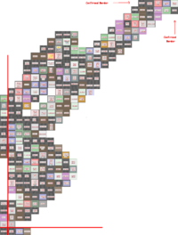
--New 22x33 map.--
It definately 22 across by 33 down, managed to tie all the screenshots together and I have personally comfirmed the SW corner. If someone could get a grid up I could fill out the northern, southern and western borders. ~ alphastarre 29th oct 5pm
- I added a swath of blocks in the southwest to south-central part of the suburb. Any errors are mine. Hopefully someone can build off those to confirm the other borders. --- Frohlicker 11:29 CST, 29 October 2008
- I noticed that Grimley Terrace Police Station is mentioned under "Police Stations" but it is not shown on the map. It is located 1 block north of Trick Walk Police Station and also there is a Davie Way Police Station 1 block south-west of the Harwarth Monument. --- Cyrus Hanley 15:36, 31 October 2008 (UTC)
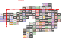
- Until Duke Garland's map is more complete, this is the best we've got for Central Borehamwood. The southern portions jibe with what I and others have seen but the north is unconfirmed. Anyone with more info, please edit away. I encourage people to add to it, but Duke's confirmed map with iwitness screenshots is the best way to go. If you're walking around, take some screenshots and update his map. Read this thread to learn how to help the mapping process. --- Frohlicker 18:15 CST, 01 November 2008


