User:Maunder
Yessir, I'm a user.
Borehamwood Maps
This section has a tinyurl: [1]
Duke Garland has created a thorough map at: User:Duke_Garland/BHW. I was inspired to do the same, thinking about how I could improve on it. So I wrote a number of scripts that largely automated the process for producing a thorough map (see below). He has (at least once) merged my map with his own. Since he has access to some private data that I don't, Duke's map is now considerably more complete.
My Maps
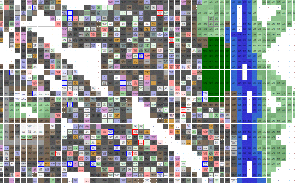
Here are the current maps as an html web page. There are three versions:
- iwmap.html [2] 6480 blocks (67%) 370K (Iwitness and equivalent records ONLY)
- mmap.html [3] 7250 blocks (75%) 402K (Iwitness merged with other data)
- smap.html [4] 9308 blocks (97%) 477K (the mmap data merged with Duke's published data]
This version incorporates ALL public iWitness reports collected through 10pm EST Nov 15.
You can help! Simply install the javascript bookmarklet [5] for publishing Iwitness records, then publish records as you wander around Borehamwood (particularly outside!). You don't have to tell me about it -- my scripts will find the records (PUBLIC only!) and add them to the database!
Iwitness will fail if a deep river is in view, or you are on a road. In such cases I have resorted to saving the page source from my web browser (View > Page Source on Firefox). If you want to send me such data, leave me a note or link on my discussion page.
A preview to give you an idea: 
Stats
Statistics on terrains and suburbs are on the map pages linked above.
Here's the top submitters of Iwitness records:
1866 iwitness records (files) processed.
 #     id=     name                   records
  1  1388011   Mulhall                   331
  2  1389521   cjo9921                   222
  3  1388623   Gerry Thompson            210
  4  1391683   Tronton Foosh             180
  5  1391040   Jack Fakename             149
  6  1388720   Taira Y                    97
  7  1389314   St Gelasius                73
  8  1391933   Dead Guppy                 73
  9  1388630   Theresa Jones              69
 10  1388191   Phoenix W                  57
 11  1386677   Simon Daniels              57
Mapping Tools
The tools have the following features:
- collect full 9-square map data (coordinates and terrain) from each record
- collect suburb name, CCTV presence, and spray-painted EYE data from each record, although these are not currently shown on the HTML map
- summarize terrain types, suburb dimensions
I will be publishing these tools when I stop working on them. It's all in perl (with a couple shell scripts thrown in).