User:Maunder
Yessir, I'm a user.
Borehamwood Maps
This section has a tinyurl: [1]
Duke Garland has created a thorough map at: User:Duke_Garland/BHW. I was inspired to do the same, thinking about how I could improve on it. So I wrote a number of scripts that largely automated the process for producing a thorough map (see below). He has (at least once) merged my map with his own. Since he has access to some private data that I don't, Duke's map is now considerably more complete.
My Maps
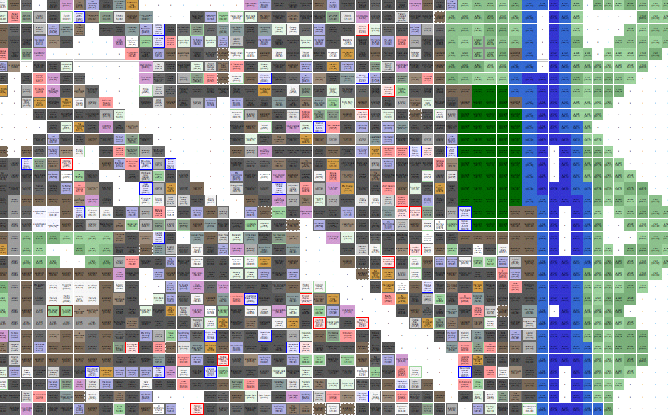
Here are the current maps as an html web page. There are three versions:
- iwmap.html [2] 6708 blocks (70%) 378K (Iwitness and equivalent records ONLY)
- mmap.html [3] 7465 blocks (78%) 409K (Iwitness merged with other data)
- smap.html [4] 9476 blocks (99%) 483K (mmap merged with Duke's published data]
Because of the many restrictions on web pages in the wiki, the maps are hosted elsewhere, so you can view the entire map at once (and save it to your own computer, if you like!).
The current maps incorporate ALL public iWitness reports collected through 10pm EST Nov 17.
You can help! Simply install the javascript bookmarklet [5] for publishing Iwitness records, then publish records as you wander around Borehamwood (particularly outside!). You don't have to tell me about it -- my scripts will find the records (PUBLIC only!) and add them to the database!
Iwitness will fail if a deep river is in view, or you are on a road. In such cases I have resorted to saving the page source from my web browser (View > Page Source on Firefox). If you want to send me such data, leave me a note or link on my discussion page.
A preview to give you an idea: 
Stats
Statistics on terrains and suburbs are on the map pages linked above.
I'll put up submitters data once the map is done.
Mapping Tools
The tools have the following features:
- collect full 9-square map data (coordinates and terrain) from each record
- collect suburb name, CCTV presence, and spray-painted EYE data from each record, although these are not currently shown on the HTML map
- summarize terrain types, suburb dimensions
I will be publishing these tools when I stop working on them. It's all in perl (with a couple shell scripts thrown in).