Central Borehamwood/News Archive
Older news from the Central Borehamwood page should be moved here.
2008
November 2008
22 November 2008
Numerous buildings near Shorey Walk Police Station have been breached --- Aelred General Hospital, the Limberye Building, the Androwes Building, St Bartholomew's Hospital. Starting to think that the south end of this suburb is going the way of South Bwood. -- Frohlicker 19:58, 22 November 2008 (UTC)
21 November 2008
Zombies appear to be organizing into packs. St Bartholomew's Hospital has five in the lobby now (down from ten before) and Urban Row Police Station was overrun this morning. Barely got out of there. Scattered radio reports of undead at Cunnigunde Hospital. They do seem to like the clinics, those things. -- Frohlicker 08:03, 21 November 2008 (UTC)
16 November 2008
A single zed inside the cades at Shorey Walk Police Station; Club Talbot also has been breached. Reports are coming in describing gunfire from the vicinity of Shute Court Police Station. Otherwise, streets seem relatively clear. No word on the situation further north.
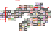
Suburb map replaced yesterday with complete version compiled by Duke Garland. Thanks for doing all that work. The new map is an image and does not hyperlink to individual locations; it is gridded, though. -- Frohlicker 19:45, 16 November 2008 (UTC)
14 November 2008
Radio reports coming in that Lovless Street Police Station was breached. No word on casualties. Minor zed presence on streets near the Shorey Walk detachment. -- Frohlicker 18:05, 14 November 2008 (UTC)
12 November 2008
Very few zeds on the streets in the south side of Central but reportedly active just south of the suburb. A few of us are holed up nearby and will be relocating to sunny Central in a day or so once we replenish our Pepsi supply. A number of survivor groups in the area have been sounding off --- a number of radios have also gone silent as the zeds remember how to open doors and get at the warm treats inside. Cunigunde General has had a zombie outpatient problem for the past few days, with radio reports of 10-15 smoking outside the Emergency entrance.
In other news, the suburb map has been updated using latest material from Duke Garland's map. I've also totaled the resource buildings and removed ambiguous links that could lead to locations in Malton. It will probably get overwritten but what the heck. -- Frohlicker 06:30, 12 November 2008 (UTC)
10 November 2008
Resource buildings updated. Map updated using Duke's map. Looking fairly complete.
Not many zeds on the streets. Radio chatter had a fair number just outside the burb near the worst-kept secret in town, but I saw very few shambling about in the south side of Central B. Many buildings loosely barricaded but a good number looking better than that. The zeds may be able to open doors but so far neither seem organized nor able to use power tools. -- Frohlicker 07:40 CST, 10 November 2008 (UTC)
3 November 2008
I made the additions to 1412 and 1413 before realizing that you guys prefer iWitnesses, so I am now doing just that. The first iWit designated as 1513 below should confirm my contribution anyhow. I took a stroll down the western area of the central blank part of the map, using ZombieKeithRichards. 1513, 1512, 1611, 1710, 1809, 1908, 2007, 2306, 2405, 2304. I hope this helps. I plan to work on that bottom row tomorrow. Cheers! --FLZombie 06:00, 3 November 2008 (UTC)
- I just noticed that there will be a major disambiguation project that will need to happen after the mapping is finished. :( --FLZombie 06:21, 3 November 2008 (UTC)
- I've been updating the suburb map as we go along (your shots have been added). Again, not as reliable as Duke's map but for now it's more comprehensive. I've crossreferenced with his map, but as soon as that one is complete, this one gets chucked in favour of it. I've cleaned up a lot of the code but it's only as good as the source material. -- Frohlicker 0138 CST, 4 November 2008
2 November 2008
Filling in some of the Southwest Corner, my mapper friends: [1], [2], [3], [4] Brother Elijah 14:21, 2 November 2008 (UTC)
October 2008
31 October 2008
I posted these Iwittys on the Eastern Borehamwood page, but I'll post them here as well. These are confirmation of Central Borehamwood's NE and SE corners.
The Northeast corner: North Central Northeast East
The Southeast Corner: Central South East Southeast
--Zarneverfike 07:04, 31 October 2008 (UTC)
Here is a java source code file that can be used to create map templates of dimensions x by y from the console/terminal. Any improvements highly appreciated. (You'll need a java compiler to run.) [5] --Quicksivlerzxc 14:17, 31 October 2008 (UTC)
29 October 2008
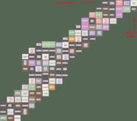
Here is my poor attempts to make a hand made map. This can be useful in some way, also, this region on my map is more more southier than Tikhon General Hospital. http://img395.imageshack.us/img395/5416/pylyuh5.gif --Pheen 11:28, 29 October 2008 (UTC)
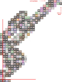
Here's a quick & dirty merge of my map and Jen's, it gives us the full NE to SW diagonal. I'm not 100% sure about the southern limit cause I got it from the western side, but I'm pretty sure it's 33 blocks.--Zolt 11:59, 29 October 2008 (UTC)
28 October 2008
Let's get a map up here ASAP. --Willdobbins
- these 8 iwitty - done @ User:Duke Garland/BHW --~~~~ [talk] 22:17, 28 October 2008 (UTC)
Yes, I am pretty abandoning Malton. BWAHAHA!! MORE MAPPING!!--Jen 21:21, 28 October 2008 (UTC)
- Screenshot transcribed into the 22x22 map, thanks! --Tybalt Peroni 10:38, 29 October 2008 (UTC)
- I went roughly along the northern edge of Central BW, finishing in West BW. Now we can figure out that the width of Central Borehamwood is 22! (My map ties nicely into the suburb map below, connecting point is Monica General Hospital). --Tybalt Peroni 21:34, 28 October 2008 (UTC)
- This screenshot has now been transcribed onto the new 22x22 map, I'm going to do Jen's now. --Tybalt Peroni 10:01, 29 October 2008 (UTC)
--Let's try filling in the new map. I can easily edit the template if we find the suburb has different dimensions than 22x22--Brad Karlin
- I can't get Iwitness to work for me. If I post some screenshots is that going to help? Is there a page somewhere where all the mapping is being centralized? - tylerisfat 22:56, 28 October 2008 (UTC)
- A set of iwitness snapshots, walking south along the western border of Central BHW. I didn't get all the way to southwestern corner... Yet. --Tybalt Peroni 00:25, 29 October 2008 (UTC)
[6] [7] [8] [9] [10] [11] [12] [13] [14] [15] [16] [17] [18] [19] [20] [21] [22] [23] [24] [25]
- Finished the route to the SW corner. Height of Central BHW is 33. --Tybalt Peroni 11:10, 29 October 2008 (UTC)


