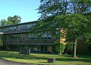
Amatt Place School
| Amatt Place School QSB, dark. AndyMatthews (talk) 12:33, 26 December 2024 (UTC)
|
| Amatt Place School
Gibsonton [85, 25]
Basic Info:
|
 |
Center Of Learning |
| This location qualifies as a Center of Learning & is considered a neutral zone for all the supporters of this policy. According to the policy, libraries, schools, zoos, and museums in the city of Malton are considered safe places. No survivor in one of these locations may be killed for any reason unless that survivor is a specified enemy. |
Amatt Place School
A three floors School.Founded byThe Amatt Family.The Amatt Place School was ounded in 1952 by The Amatt Family, The Amatt live in Gibsonton since 1835.The school was founded by William Henry Amatt in June 12, 1952.Anthony Amatt was the director since 1980.
Before the Outbreak
June 12th 2007
You can see a big poster outside the school Happy Anniversary say. The 12th of June 2007 was the 55th anniversary of the Amat Place Shool.All graduated come to visit their old school. Remember the time! Remember when in 2004 the 5th grade made a trip to France! you remember? Great times!. Remember old Director Jhonny Amatt? Was a real good football player.
Description
Amatt Place School and the surrounding area are controlled by the Benzuli Expansion, commanded by Vokshod. The area is designated Neutral Zone Two.
History
Previously adopted by the Gibsonton Defense Alliance as an HQ.
Barricade Policy
EHB at all times.
Current Status
| This page, Amatt Place School, is a locations stub. Please help us to improve the wiki by contributing to this page. Be sure the following information is added to the page: coordinates, suburb, 9 block map (or 16 block map for large buildings), description, barricading policy, and history. Please refer to the Location Style Guide. |
