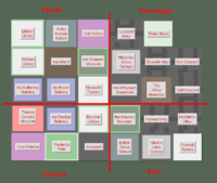
Northeast Borehamwood
| Region of Northeast Borehamwood | |||||||||||||||||||||||
| |||||||||||||||||||||||
| Update Northeast Borehamwood's Danger Level | |||||||||||||||||||||||
Known groups in this region:
| |||||||||||||||||||||||
| Phone Mast: |

|
Please remember to keep this article neutral. |
Northeast Borehamwood is a suburb of Borehamwood.
Resource Buildings
|
Fire Stations
|
Hospitals
|
|
Police Stations
| |
|
Shopping Centres
|
Billboards |
Radio
Template:BorehamwoodRadioFreqThe current proposed radio frequency by the B.R.F.
Recent News
Please: recent news at the top (signed & NPOV). Old news can be archived.
November 2008
November 7 2008
Suggest updating the safety status of the area: Full of zombies, at least 30+ from a few seconds glance. That's just in a few blocks around Blaise General. Several buildings ruined, only a handful of buildings lit. One hospital has 19 zeds.... Looks like the zombies have gained a foothold.
November 5 2008
Final and accurate map of Northeast Borehamwood posted to my left. Keep in mind that the coordinates I have in place were only there to aid me in the process of mapping (when I began mapping nobody knew the actual coordinates of anywhere and now it would be too tedious to go through and modify all of them). Also, if somebody could use my image to code the map at the bottom of this page - would be great. Clovıs Kıngdom/Talk/Contrıbs 22:02, 5 November 2008 (UTC)
- Working on it, should have it done by the end of the 9th (or sooner) if all goes well. Any idea on those coordinates? Might be a good idea to get them in eventually for people wandering the fields.--G-Man 17:28, 8 November 2008 (UTC)
November 4 2008
Updated map of Northeast Borehamwood. I will take down the first versions from this page. Clovıs Kıngdom/Talk/Contrıbs 18:07, 4 November 2008 (UTC)
November 3 2008
Here is some confirmation of Northeast Borehamwood's SE and SW corners
the Southwest corner: North Central Northeast East
the Southeast corner: Northeast Countryside 1 East Countryside 2.
By my count, this makes Northeast Borehamwood's southern border 21 long. --Zarneverfike 09:19, 3 November 2008 (UTC)
November 3 2008
On the left is an updated map of NE Borehamwood. If someone would be so kind as to code it into the Suburb section below, that would be greatly appreciated. I started earlier but it's too tedious to do that plus going around mapping... Clovıs Kıngdom/Talk/Contrıbs 06:27, 3 November 2008 (UTC)
November 1 2008
On the right is the beginning of the northeastern part of Borehamwood. The bottom left corner is the one shown in the map above that depicts the suburb borders. Also, keep in mind that the coordinates are only there because they are useful to me when I make the map, they don't reflect in any way the actual Borehamwood coordinates. Courtesy of the Head Zombie Assassin of Kingdom :) Clovıs Kıngdom/Talk/Contrıbs 22:37, 1 November 2008 (UTC)
October 2008
October 28 2008
The mapping of this suburb has begun! (note that coorindates are not known for locations below)
A tiny, tiny bit of it...but shows where it borders other suburbs. --Jen 21:48, 28 October 2008 (UTC)
--Look at Central Borehamwood's new map template 22x33, and feel free to use it. Our suburb is confirmed to be 22 blocks wide and 33 blocks high. Hopefully all suburbs are of similar dimensions.--
Pottsway Police station is SE of St. Simeon's Hospital. Kingdom will be setting up a first aid station for survivors ASAP. Ask for a Kingdom heal. Rubyranger7
Suburb Map
Northeast Borehamwood Barricade Plan
Currently a work in progress.
Northeast Borehamwood Safety Map
The Northeast Borehamwood Safety Map presents the map of Northeast Borehamwood in a table with the grid locations. Please note the actual coordinates are not used, as they are N/A.
Template:NortheastBorehamwoodNEBSM
Northeast Borehamwood Zombie Position Map
Currently a work in progress.

