Dolbridge Street (Pegton)
| Dolbridge Street
Pegton [84, 56]
Basic Info:
|
Description
An historic street with a dilapidated iron bridge across a trickle which is all that remains of the Peggbrook. A billboard stands by the bridge, which once listed the tolls for various vehicles (although no cars, buses or mopeds are still operational in Malton).
History

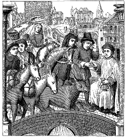
In medieval times, the Peggbrook was a noted waterway, much larger than today (most of the Peggbrook is now underground, or diverted to the River Kevan to the north). As a result, the wise Peggs were able to raise revenue from out-of-town traders by charging a toll for the use of the bridge which they had specially constructed at this strategic point, where the heights of southwestern Pegton drop to meet the northeastern flatlands.
The original stone bridge cut journey times dramatically, especially for mule traders, and contributed to the medieval prosperity of the suburb. With the advent of the motorcar, the new iron bridge became even more important; however, the advent of the zombie has resulted in its rapid decay as no-one dares venture out to paint its rusting ironwork any more.
