Category:Maps
From The Urban Dead Wiki
Jump to navigationJump to search
Resources » Player Resources » Maps
Resources » Game Resources » Maps
This is a listing of maps and diagrams.
Subcategories
This category has the following 7 subcategories, out of 7 total.
Pages in category "Maps"
The following 65 pages are in this category, out of 65 total.
E
M
- Mall Status Map
- Malton Map
- Template:Malton TRP Map
- Map Template
- User:Maps/Malton TRP Map
- Megaurb Mockridge Hills
- Minimap
- User:MHSstaff/MaltonTRPOldMap
- User:MHSstaff/TRPMapAll
- User:MHSstaff/TRPMapFAK
- User:MHSstaff/TRPMapGasNGen
- User:MHSstaff/TRPMapGuns
- User:MHSstaff/TRPMapRevive
- User:MHSstaff/TRPtest
- User:MHSstaff/TRPText
- Minions of the Apocalypse/Gulsonside ruination map
- MPM Status Map
S
- Template:S42
- Scenteral Intelligence Map
- Scenteral Intelligence Map/grid map
- Scenteral Intelligence Map/grid map/show buildings
- Scenteral Intelligence Map/grid map/show streets
- SSF patrol map
- SSZ Maps
- Strategic Buildings Status Map
- Suburb
- Suburb Navigation Map
- Suburb Numbers
- Template:SuburbInformationCenterMap
T
Media in category "Maps"
The following 200 files are in this category, out of 363 total.
(previous page) (next page)- 2021 New Years Naked run map.png 500 × 429; 126 KB
- Au2008.jpg 560 × 420; 46 KB
- Danger Report Cleanup.png 761 × 591; 1.29 MB
- DangerMap 20130628.png 759 × 600; 133 KB
- DEM NE.JPG 448 × 448; 32 KB
- DEM NW.JPG 448 × 448; 33 KB
- DEM SE.JPG 448 × 448; 33 KB
- DEM SW.JPG 448 × 448; 33 KB
- DistrictRADIO.png 200 × 200; 2 KB
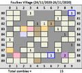
- Foulkes village 24 11 2020.png 465 × 414; 15 KB
- Hospital 3 project test.gif 516 × 348; 32 KB
- -Creedy- 2010-09-18 102934.png 671 × 596; 43 KB
- 00480378.jpg 1,024 × 521; 69 KB
- 080612-suburb-dangermap.png 803 × 603; 65 KB
- 080624-suburb-dangermap.png 802 × 602; 66 KB
- 080709-suburb-dangermap.png 803 × 603; 38 KB
- 2008, June 17.PNG 800 × 601; 37 KB
- 20080618-suburb-dangermap.png 804 × 605; 66 KB
- 29 aug.jpg 983 × 699; 105 KB
- 450px-Ssz contained.PNG 225 × 284; 44 KB
- 4Corners DNA Route 1.JPG 520 × 669; 85 KB
- 4Corners DNA Route 2.JPG 520 × 669; 84 KB
- Ackland Mall.jpg 495 × 326; 40 KB
- AGABmap.png 507 × 504; 22 KB
- Antipk.jpg 848 × 1,087; 223 KB
- August 7th.jpg 1,224 × 674; 544 KB
- Autumn in Gulsonside.png 227 × 218; 3 KB
- Awakenings-plan.png 989 × 500; 116 KB
- Axes County.PNG 1,018 × 539; 59 KB
- Axis1.png 131 × 288; 26 KB
- Axis2.png 191 × 159; 29 KB
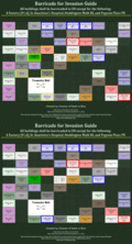
- Barracade-Plan.jpg 363 × 334; 41 KB
- Barricade Map.JPG 786 × 673; 121 KB
- Barricade plan.JPG 608 × 441; 73 KB
- Based.JPG 700 × 500; 68 KB
- Bashpath.jpg 748 × 750; 1.07 MB
- BB061307.jpg 264 × 264; 13 KB
- Bellow.jpg 551 × 550; 88 KB
- Betterplan-dinnerbell.png 391 × 135; 58 KB
- BIG1.GIF 1,050 × 967; 609 KB
- BigBashMap 10 29.jpg 748 × 750; 716 KB
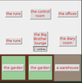
- Bigbrother.PNG 532 × 299; 8 KB
- Bigbrotherlounge.png 302 × 307; 8 KB
- Billb.gif 36 × 32; 1 KB
- Binoc outside.PNG 168 × 168; 1 KB
- Blackmore Route.png 757 × 645; 9 KB
- Blackmorebellow.png 234 × 234; 8 KB
- Blockparty.png 711 × 509; 54 KB
- Borehamwood river.png 490 × 490; 2 KB
- Borehamwood-duke.png 490 × 490; 16 KB
- Borehamwood-map-preview.png 954 × 593; 373 KB
- Borehamwood-regions.png 490 × 490; 8 KB
- BOWbarricade.jpg 828 × 1,018; 161 KB
- BOWbarricadeplanversion2.0.JPG 828 × 972; 164 KB
- Brigadeprotectorate.jpg 646 × 592; 76 KB
- Brookside Medic Run 1.gif 350 × 686; 33 KB
- Brookside North.png 547 × 676; 44 KB
- Brookside South Run.JPG 643 × 595; 96 KB
- Brookside South.png 922 × 439; 45 KB
- BrooksvilleUBP-small.gif 497 × 405; 67 KB
- BrooksvilleUBP.gif 994 × 810; 138 KB
- Caiger Mall.jpg 489 × 310; 38 KB
- CentralBorheam2.png 2,548 × 3,360; 445 KB
- CERN.png 800 × 450; 186 KB
- CFR.png 500 × 588; 378 KB
- Creedy - 2010-09-19 110100.png 330 × 408; 13 KB
- Creedy - 2010-09-20 222558.png 486 × 493; 27 KB
- Creedy - 2010-09-23 105410.png 389 × 391; 18 KB
- CreedyFR.jpg 240 × 290; 68 KB
- CreedyOM.jpg 240 × 290; 65 KB
- CSOF-WCT 06 HQ FILE.jpg 2,184 × 1,683; 281 KB
- Da plan 1 copy.jpg 254 × 262; 74 KB
- Da plan 2 copy.jpg 721 × 537; 421 KB
- DakerstownTRPMap.png 361 × 371; 5 KB
- Dawn.png 316 × 295; 8 KB
- DeadRunnerMap.jpg 275 × 275; 32 KB
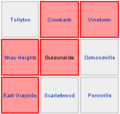
- DeleteTollyton.png 200 × 185; 11 KB
- Dentonside Barricade Plan 2.PNG 700 × 645; 59 KB
- Dentonside.jpg 718 × 541; 326 KB
- DES-NE.jpg 524 × 492; 160 KB
- DH-BPE-Approved-Policy.png 655 × 817; 171 KB
- Division-seperation.gif 157 × 157; 105 KB
- Dmap08162008.PNG 806 × 606; 48 KB
- DNAScan91106.jpg 252 × 297; 17 KB
- Dowdney Attack.PNG 680 × 1,109; 75 KB
- Dstrict-seperation.gif 150 × 165; 103 KB
- Edstinymap.gif 705 × 712; 244 KB
- EgMiltown1.jpg 500 × 500; 58 KB
- EgMiltown2.jpg 500 × 500; 57 KB
- Elstree exploring row87 90.PNG 2,760 × 1,120; 240 KB
- Elstree NW part.PNG 2,023 × 1,471; 193 KB
- Elstree South border.PNG 3,250 × 774; 205 KB
- Elstree Suburb layout.PNG 500 × 500; 9 KB
- Elstree west border.PNG 500 × 1,633; 73 KB
- Farmer Building Assault 1.0.JPG 415 × 509; 43 KB
- Finalcadeplan.jpg 762 × 792; 391 KB
- FORT PERRYN.JPG 477 × 412; 43 KB
- FortPerynRevison.gif 285 × 275; 6 KB
- Free running mast roads.PNG 722 × 722; 5 KB
- Free Running Route.jpg 1,347 × 858; 252 KB
- G'side and environs.png 228 × 217; 3 KB
- GatcombetonScoutReport.PNG 484 × 420; 11 KB
- Gerard Crescent Precint.jpg 423 × 317; 124 KB
- Germany WC.png 436 × 545; 67 KB
- Gh broadway-s.jpg 572 × 328; 57 KB
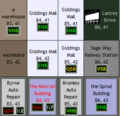
- Giddings Mall 2010-09-19 110406.png 276 × 266; 10 KB
- Greentown Scout.PNG 755 × 698; 109 KB
- Group1march.jpg 400 × 248; 38 KB
- Group2march.jpg 436 × 255; 43 KB
- Hall Dewes Buildings.jpg 332 × 420; 49 KB
- HarencBuildingNecronet.GIF 286 × 307; 12 KB
- HermanBuildingNecronet.png 289 × 279; 14 KB
- Hillard Road Precint.jpg 421 × 308; 145 KB
- HMDG-run.png 776 × 617; 134 KB
- HumphyrsScout.jpg 999 × 999; 258 KB
- IBM-2-4-09.png 801 × 801; 38 KB
- Immcoverage.JPG 397 × 398; 51 KB
- Inquisitiontemporary1.PNG 207 × 158; 3 KB
- Island13.PNG 345 × 332; 11 KB
- JollyLights2007.gif 619 × 421; 44 KB
- KeningBuildingNecronet.png 294 × 286; 11 KB
- Ketchelbank 07 07 07.png 995 × 990; 218 KB
- Ketchelbanktrip.JPG 803 × 1,200; 164 KB
- KKMapRoute.jpg 799 × 799; 147 KB
- Laimbeer Route.jpg 636 × 523; 42 KB
- Lakes.jpg 320 × 321; 57 KB
- Lanceblockbp.PNG 350 × 322; 15 KB
- LatrobeBuildingNecronet.png 298 × 288; 10 KB
- LB062307.jpg 277 × 294; 17 KB
- LBarricade.PNG 276 × 614; 8 KB
- LemonTracker.jpg 1,254 × 672; 241 KB
- LemonTrackerArchive.jpg 1,254 × 672; 161 KB
- Lerwill scouting.png 787 × 697; 99 KB
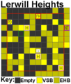
- LerwillHeightsBP.png 312 × 366; 9 KB
- Little bit of central.JPG 514 × 716; 77 KB
- LocationMRW.png 800 × 600; 5 KB
- Lolsuburbnames.JPG 1,280 × 1,024; 316 KB
- LukinswoodSurvivorSpam.jpg 296 × 312; 21 KB
- LURCSarea.PNG 435 × 482; 19 KB
- Mall defence4.JPG 702 × 702; 131 KB
- Mall Tour 07 route.JPG 0 × 0; 1.84 MB
- Mall-2.PNG 194 × 279; 5 KB
- Mall-status-map.png 804 × 804; 20 KB
- Mall3.JPG 457 × 319; 35 KB
- Mallmap.PNG 507 × 507; 10 KB
- MallTour2.jpg 275 × 298; 35 KB
- Malton Zoo Buildings.PNG 620 × 465; 27 KB
- MaltonBeltM.jpg 501 × 500; 123 KB
- MaltonCityPark.PNG 701 × 643; 51 KB
- MaltonCityParkAlt2.PNG 701 × 643; 52 KB
- Maltonmap-screenshot.jpg 500 × 414; 94 KB
- Maltonmap-screenshot2.jpg 400 × 444; 63 KB
- MaltonU.jpg 650 × 376; 88 KB
- MaltonUx.jpg 650 × 380; 80 KB
- Map diag 01.gif 202 × 127; 2 KB
- Map of Crawforde.PNG 713 × 560; 28 KB
- Mapborecentral1.PNG 2,218 × 1,965; 210 KB
- Mapborecorners.PNG 771 × 651; 39 KB
- Mapborenw.PNG 1,667 × 1,091; 109 KB
- Mapborenw2.png 667 × 692; 33 KB
- Mapboresw.PNG 1,563 × 1,493; 110 KB
- MapcentralBW peroni.png 1,982 × 1,236; 224 KB
- Mapofoperations.PNG 669 × 573; 301 KB
- Mar5-1812GMT.png 310 × 451; 32 KB
- Marathon route.jpg 625 × 624; 100 KB
- MarDrakeZerg.jpg 599 × 300; 45 KB
- Masts Deuteranope.jpg 400 × 349; 41 KB
- Masts Protanope.jpg 400 × 349; 41 KB
- Masts.JPG 400 × 349; 46 KB
- McZedWorld.jpg 714 × 534; 76 KB
- Megaurb Resistance.jpg 694 × 1,000; 129 KB
- Mellish Walk Precint.jpg 421 × 317; 140 KB
- Minimap border Borehamwood.png 301 × 326; 4 KB
- Minimap border malton.png 300 × 325; 10 KB
- MiniNT.gif 100 × 100; 10 KB
- Miskamap.jpg 982 × 702; 152 KB
- MMTM malls example.png 941 × 616; 57 KB
- Mobile Phone Mast Locations.gif 748 × 750; 55 KB
- Molebank - small.png 758 × 653; 83 KB
- Monroeville-duke.png 490 × 490; 16 KB
- MonroevilleWalking.jpg 757 × 775; 103 KB
- Montacute Bldg Assault Map 1.2.JPG 840 × 578; 99 KB
- Museum Map.JPG 799 × 799; 183 KB
- Mv-central.png 98 × 98; 3 KB
- Mv-newtown.png 98 × 98; 3 KB
- Mv-oak.png 98 × 98; 3 KB
- Mv-outside.png 98 × 98; 3 KB
- Mv-south.png 98 × 98; 3 KB
- Mv-west.png 98 × 98; 3 KB
- My journey in UD.JPG 800 × 799; 257 KB
- My journey in UD1.JPG 600 × 599; 151 KB
- NE Region jpg.jpg 559 × 491; 161 KB
- NEBorehamwood22x21.jpg 1,240 × 1,528; 418 KB
- NEBorehamwoodFull.jpg 1,236 × 1,933; 555 KB
- Necrotech highlight.PNG 317 × 426; 10 KB
- NecroWatchRoute.JPG 481 × 401; 52 KB
- NeedleblitzD.jpg 328 × 461; 43 KB
- NEMaltonTrek.png 400 × 400; 21 KB
- Network1.JPG 567 × 564; 100 KB
- NewArkham UBP.png 797 × 556; 41 KB
