Northwest Borehamwood: Difference between revisions
Rosslessness (talk | contribs) |
Rosslessness (talk | contribs) |
||
| Line 90: | Line 90: | ||
location10=[[field|a field]]|location10_color=field| | location10=[[field|a field]]|location10_color=field| | ||
location11=[[field|a field]]|location11_color=field| | location11=[[field|a field]]|location11_color=field| | ||
location12= | location12=Ayre Yard Garage|location12_color=Auto Repair| | ||
location13=[[woodland]]|location13_color=woodland| | location13=[[woodland]]|location13_color=woodland| | ||
location14=a railway line|location14_color=Railway| | location14=a railway line|location14_color=Railway| | ||
| Line 99: | Line 99: | ||
location19=[[field|a field]]|location19_color=field| | location19=[[field|a field]]|location19_color=field| | ||
location20=[[field|a field]]|location20_color=field| | location20=[[field|a field]]|location20_color=field| | ||
location21= | location21=Ammonds Grove School|location21_color=School| | ||
location22=[[Factory|a factory]]|location22_color=Factory| | location22=[[Factory|a factory]]|location22_color=Factory| | ||
location23=[[woodland]]|location23_color=woodland| | location23=[[woodland]]|location23_color=woodland| | ||
| Line 109: | Line 109: | ||
location29=[[field|a field]]|location29_color=field| | location29=[[field|a field]]|location29_color=field| | ||
location30=[[field|a field]]|location30_color=field| | location30=[[field|a field]]|location30_color=field| | ||
location31= | location31=Gosney Grove|location31_color=Street| | ||
location32= | location32=Hawke Street|location32_color=Street| | ||
location33= | location33=the Chitty Museum|location33_color=Museum| | ||
location34=a railway line|location34_color=Railway| | location34=a railway line|location34_color=Railway| | ||
location35= | location35=Wheddon Walk Fire Station|location35_color=Fire Station| | ||
location36=[[field|a field]]|location36_color=field| | location36=[[field|a field]]|location36_color=field| | ||
location37=[[field|a field]]|location37_color=field| | location37=[[field|a field]]|location37_color=field| | ||
| Line 123: | Line 123: | ||
location43=Isgar Library|location43_color=library| | location43=Isgar Library|location43_color=library| | ||
location44=a railway line|location44_color=Railway| | location44=a railway line|location44_color=Railway| | ||
location45= | location45=Elmund Square|location45_color=Street| | ||
location46=[[field|a field]]|location46_color=field| | location46=[[field|a field]]|location46_color=field| | ||
location47=[[field|a field]]|location47_color=field| | location47=[[field|a field]]|location47_color=field| | ||
| Line 134: | Line 134: | ||
location54=a railway line|location54_color=Railway| | location54=a railway line|location54_color=Railway| | ||
location55=[[Wasteland|wasteland]]|location55_color=Wasteland| | location55=[[Wasteland|wasteland]]|location55_color=Wasteland| | ||
location56= | location56=Walmsley Terrace Police Station|location56_color=Police Dept| | ||
location57= | location57=the Stolley Hotel|location57_color=Hotel| | ||
location58=Lawrie Place Garage|location58_color=garage| | location58=Lawrie Place Garage|location58_color=garage| | ||
location59=Woolaway Library|location59_color=library| | location59=Woolaway Library|location59_color=library| | ||
| Line 143: | Line 143: | ||
location63=Dunstone Square|location63_color=Street| | location63=Dunstone Square|location63_color=Street| | ||
location64=a railway line|location64_color=Railway| | location64=a railway line|location64_color=Railway| | ||
location65= | location65=Beedall Towers|location65_color=Tower| | ||
location66= | location66=Busker Alley|location66_color=Street| | ||
location67= | location67=Wiltshire Bank|location67_color=Bank| | ||
location68= | location68=Caller Gardens|location68_color=Street| | ||
location69=Lessey Row|location69_color=street| | location69=Lessey Row|location69_color=street| | ||
location70=Gifford Place|location70_color=Street| | location70=Gifford Place|location70_color=Street| | ||
| Line 154: | Line 154: | ||
location74=a railway line|location74_color=Railway| | location74=a railway line|location74_color=Railway| | ||
location75=Bane Alley|location75_color=Street| | location75=Bane Alley|location75_color=Street| | ||
location76= | location76=Battersby Park|location76_color=Park| | ||
location77=[[Wasteland|wasteland]]|location77_color=Wasteland| | location77=[[Wasteland|wasteland]]|location77_color=Wasteland| | ||
location78=St Birgitta's Hospital|location78_color=Hospital| | location78=St Birgitta's Hospital|location78_color=Hospital| | ||
| Line 164: | Line 164: | ||
location84=a railway line|location84_color=Railway| | location84=a railway line|location84_color=Railway| | ||
location85=Donn Crescent|location85_color=Street| | location85=Donn Crescent|location85_color=Street| | ||
location86= | location86=St Alexander's Church|location86_color=Church| | ||
location87=a cemetery|location87_color=cemetery| | location87=a cemetery|location87_color=cemetery| | ||
location88=[[Wasteland|wasteland]]|location88_color=Wasteland| | location88=[[Wasteland|wasteland]]|location88_color=Wasteland| | ||
Revision as of 23:31, 28 October 2008
| Region of Northwest Borehamwood |
| Known Groups | |
Northwest Borehamwood is a suburb of Borehamwood.
Resource Buildings
|
Fire Stations
|
Hospitals
|
|
Police Departments
|
Malls |
|
Bulletin Boards
|
Recent News
Please: recent news at the top (signed & NPOV). Old news can be archived.
October 2008
October 28 2008
The mapping of this suburb has begun! (note that coorindates are not known for locations below)
Can this help? 1, 2, 3, 4, 5, 6, 7 --Janus Abernathy 19:28, 28 October 2008 (UTC)
- parsed all these iwitty's to my map db. you can see result here User:Duke Garland/BHW. peeeps, more iwitty = more me parsing it. i'm not gonna parse your own weird format... --~~~~ [talk]
- 'kay. My format is awesome btw =P Nah, just kidding. Thanks. --Janus Abernathy 21:59, 28 October 2008 (UTC)
The first group in Borehamwood's history is formed. (Historic!) They are Big Survivors Little Survivor. --RosslessnessWant a Location Image? 14:42, 28 October 2008 (UTC)
Someone else can take care of all the fancy wiki code. :P --Jen 16:14, 28 October 2008 (UTC)
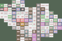
Mapping at this point is sketchy. Map 1 (Below) is north of Map 2 (Below) Map 3 (Below) is to the East of Map 1 and Map 4 (Also below is to the West.
Suburb Map part 1
| The Malton Suburb of Northwest Borehamwood | |||||||||||||||||||||||||||||||||||||||||||||||||||||||||||||||||||||||||||||||||||||||||||||||||||||||||||||
|
Suburb Map part 2
| The Malton Suburb of Northwest Borehamwood | |||||||||||||||||||||||||||||||||||||||||||||||||||||||||||||||||||||||||||||||||||||||||||||||||||||||||||||
|
Suburb Map part 3
| The Malton Suburb of Northwest Borehamwood | |||||||||||||||||||||||||||||||||||||||||||||||||||||||||||||||||||||||||||||||||||||||||||||||||||||||||||||
|
Suburb Map part 4
| The Malton Suburb of Northwest Borehamwood | |||||||||||||||||||||||||||||||||||||||||||||||||||||||||||||||||||||||||||||||||||||||||||||||||||||||||||||
|
