The Pridham Building (West Boundwood): Difference between revisions
From The Urban Dead Wiki
Jump to navigationJump to search
Greenwarrior (talk | contribs) (Scent map update) |
|||
| Line 25: | Line 25: | ||
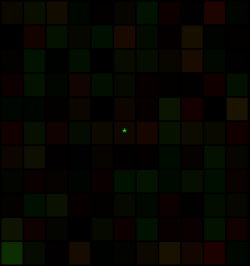
This block has been chosen as a location for [[Zombie Skills/Scent Death|scentoral imaging]] by [[Z.A.L.P.|harman conservationists]] who use it to maintain a [[Z.A.L.P./Scent Maps|full migratory map]] of zombie movements throughout Malton. [[Z.A.L.P./Scent Maps#Instructions|damage-resistant, zombah-friendly keypads]] have been installed for the uploading of data. <br><br> | This block has been chosen as a location for [[Zombie Skills/Scent Death|scentoral imaging]] by [[Z.A.L.P.|harman conservationists]] who use it to maintain a [[Z.A.L.P./Scent Maps|full migratory map]] of zombie movements throughout Malton. [[Z.A.L.P./Scent Maps#Instructions|damage-resistant, zombah-friendly keypads]] have been installed for the uploading of data. <br><br> | ||
[[Image:38x5.PNG|250px]]<br> | [[Image:38x5.PNG|250px]]<br> | ||
Field agent= | Field agent=[[User:Greenwarrior|Greenwarrior]] 00:55, 20 May 2011 (BST)<br> | ||
[[Z.A.L.P./Scent Maps#Instructions|Update Image]] | [[Z.A.L.P./Scent Maps#Instructions|Update Image]] | ||
Revision as of 23:55, 19 May 2011
| The Pridham Building |
| the Pridham Building
West Boundwood [38, 5]
Basic Info:
|
The Pridham Building (West Boundwood)
Description
History
Barricade Policy
Current Status
Scentoral Imaging Location
This block has been chosen as a location for scentoral imaging by harman conservationists who use it to maintain a full migratory map of zombie movements throughout Malton. damage-resistant, zombah-friendly keypads have been installed for the uploading of data.
Field agent=Greenwarrior 00:55, 20 May 2011 (BST)
Update Image
| This page, The Pridham Building (West Boundwood), is a locations stub. Please help us to improve the wiki by contributing to this page. Be sure the following information is added to the page: coordinates, suburb, 9 block map (or 16 block map for large buildings), description, barricading policy, and history. Please refer to the Location Style Guide. |
