Category:Fire Stations
From The Urban Dead Wiki
Jump to navigationJump to search
This is a list of all the Fire Stations in Malton. Charts for other locations are available as well. For an explanation of how this works, please read the Map description. For a more detailed view of the dying city, please check out the official map project.
Uses the Map Template.
Pages in category "Fire Stations"
The following 200 pages are in this category, out of 240 total.
(previous page) (next page)A
B
- Barens Road Fire Station
- Barling Boulevard Fire Station
- Barnett Boulevard Fire Station
- Barrington Court Fire Station (Borehamwood)
- Barter Road Fire Station
- Bassence Row Fire Station
- Beddington Walk Fire Station
- Bendells Row Fire Station
- Berrow Road Fire Station
- Billet Road Fire Station
- Billings Row Fire Station
- Birt Crescent Fire Station
- Bisdee Road Fire Station
- Boode Place Fire Station
- Boole Place Fire Station
- Boxall Road Fire Station
- Branagan Row Fire Station
- Branch Road Fire Station (Monroeville)
- Brent Place Fire Station
- Brockway Row Fire Station
- Brokbury Row Fire Station
- Bryan Place Fire Station
- Bubcar Road Fire Station
- Bugby Place Fire Station
- Burden Road Fire Station
- Burke Place Fire Station (Monroeville)
- Burrough Row Fire Station
- Bush Crescent Fire Station
C
- Cade Place Fire Station
- Castleman Walk Fire Station
- Catcott Row Fire Station
- Channell Lane Fire Station
- Cheek Road Fire Station
- Cherington Drive Fire Station
- Chibbett Lane Fire Station
- Chidley Row Fire Station
- Chudley Row Fire Station
- Clarkson Lane Fire Station
- Cocker Boulevard Fire Station
- Comitty Row Fire Station
- Condon Boulevard Fire Station
- Conolly Row Fire Station
- Cookesley Walk Fire Station
- Cottingham Drive Fire Station
- Councell Lane Fire Station
- Courtney Lane Fire Station
- Cowen Road Fire Station
- Cradock Row Fire Station
- Crosse Boulevard Fire Station
- Cudworth Lane Fire Station
D
- Dales Boulevard Fire Station
- User:Damocles S/NotleyWalkFD
- User:Damocles S/ParryDriveFD
- Dann Square Fire Station (Borehamwood)
- Demack Row Fire Station
- Dempsey Lane Fire Station
- Dennis Row Fire Station
- Deverell Walk Fire Station
- Dinham Row Fire Station
- Doig Road Fire Station
- Donoghan Walk Fire Station
- Dovey Boulevard Fire Station
- Downs Boulevard Fire Station
- Dudman Row Fire Station
- Dunford Lane Fire Station (Dartside)
- Dunford Lane Fire Station (Paynterton)
- Dunstone Walk Fire Station
- Dyment Row Fire Station
E
F
G
- Gable Walk Fire Station
- Garlick Square Fire Station
- Garrow Drive Fire Station
- Gell Lane Fire Station
- Gentle Drive Fire Station
- Gerrish Square Fire Station
- Getsom Drive Fire Station
- Gibbes Drive Fire Station
- Giverd Drive Fire Station
- Gleeson Square Fire Station
- Grimmer Square Fire Station
- Guilford Avenue Fire Station
H
- Haggas Square Fire Station
- Hagger Square Fire Station
- Haim Walk Fire Station
- Hamm Walk Fire Station
- Headland Street Fire Station
- Healy Drive Fire Station
- Higgin Square Fire Station
- Hitchens Street Fire Station
- Hodgkinson Row Fire Station
- Holdsworth Row Fire Station
- Hollester Boulevard Fire Station
- Honeybone Boulevard Fire Station
- Hooper Square Fire Station
- Horrigan Street Fire Station
- Horsey Square Fire Station
- Horton Square Fire Station
- Huggins Avenue Fire Station
- Hulin Drive Fire Station
K
L
- Lake Street Fire Station
- Lambourn Walk Fire Station
- Langman Lane Fire Station
- Langsford Drive Fire Station
- Lea Avenue Fire Station
- Learmond Walk Fire Station
- Lettey Row Fire Station
- Lindsey Lane Fire Station
- Lomas Boulevard Fire Station
- Lowther Lane Fire Station
- Ludwell Lane Fire Station
- Luellin Lane Fire Station
M
- MacLaverty Avenue Fire Station
- Maddocks Drive Fire Station
- Massey Lane Fire Station
- Mattick Walk Fire Station
- Mays Boulevard Fire Station
- McCormack Square Fire Station
- McDonald Drive Fire Station
- McGarth Walk Fire Station
- Meaker Lane Fire Station
- Meetcham Drive Fire Station
- Melbourne Square Fire Station
- Mellish Walk Fire Station
- Membry Lane Fire Station
- Merryweather Way Fire Station
- Michaud Walk Fire Station
- Millerd Walk Fire Station
- Millett Walk Fire Station
- Mitchell Drive Fire Station
- Money Row Fire Station
- Montgomery Avenue Fire Station
- Morrhall Drive Fire Station
- Morton Lane Fire Station
N
P
- Pardoe Square Fire Station
- Parkhouse Way Fire Station
- Parry Drive Fire Station
- Paskin Square Fire Station
- Pegrum Square Fire Station
- Penni Drive Fire Station
- People of Malton/Headquarters
- Percival Street Fire Station
- Perrie Square Fire Station
- Pigitt Square Fire Station
- Pimm Walk Fire Station
- Pine Walk Fire Station
- Polwhiele Way Fire Station
- Postlethwaite Crescent Fire Station
- Poultney Street Fire Station
- Prickett Street Fire Station
- Prideaux Street Fire Station
- Priestly Street Fire Station
- Purt Walk Fire Station
R
Media in category "Fire Stations"
This category contains only the following file.
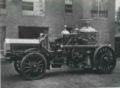 1912FireEngine.jpg 547 × 400; 22 KB
